Category Archives: CO

San Isabel National Forest – Baldwin Lake/Camping

This adventure was by far the most challenging we’ve experienced in every way possible. We would drive to the trailhead on a two-way narrow, winding road absolutely littered with rocks and boulders.  Our hike would end up being a 5 hour, 8.5 mile trek that elevated 2000’ with our highest elevation being over 13,000’.

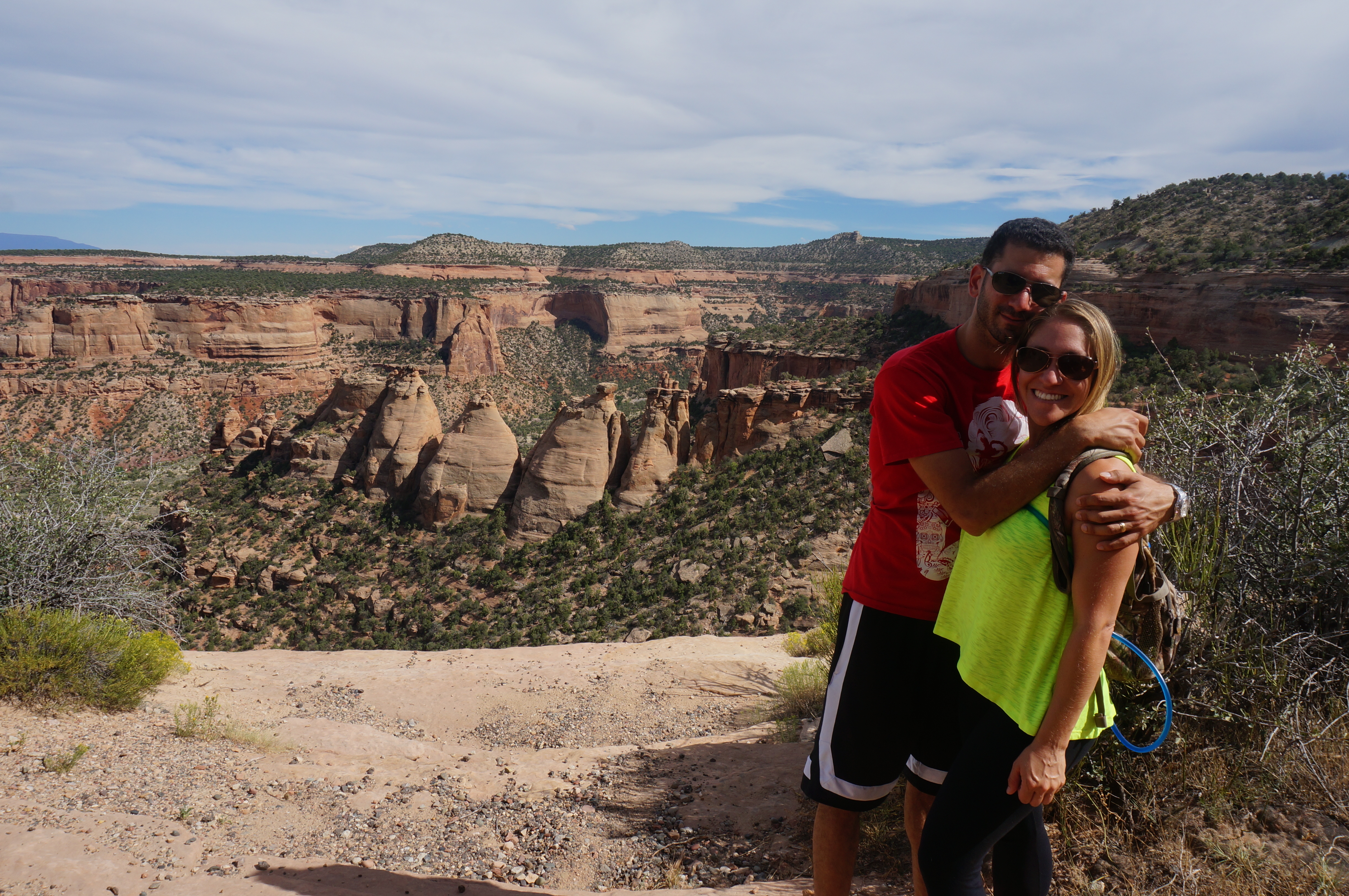
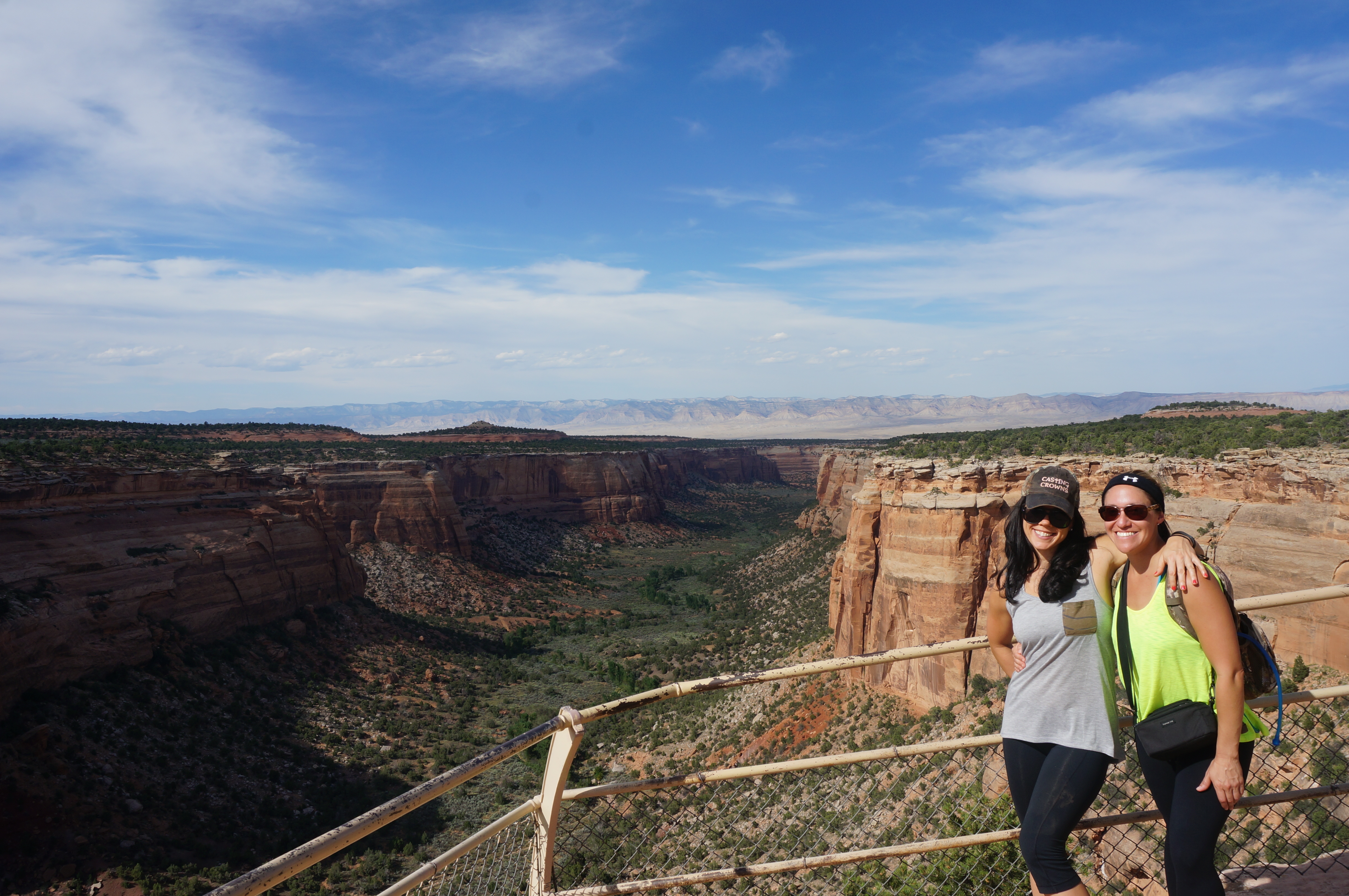
But as you can see from the picture, it was worth it!

Balwin - Intro Pic

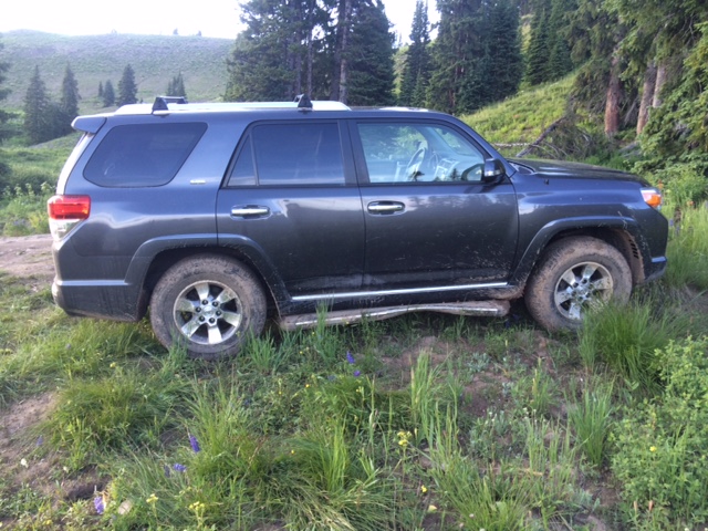
I read a lot about how difficult the terrain would be on the way up to the trailhead (this site helped a lot), but was convinced that our last off road experience was pretty rough and that the 4Runner could handle it.  Well, the 4Runner did its job, but I’m thinking it’s time to raise her up and replace the stock tires.  There were huge rocks bulging out of the already uneven, steep rocky road that made me wish for an extra couple inches of ground clearance.  I was a bit jealous when we saw raised Jeep Wranglers with monster tires on them just owning the road.

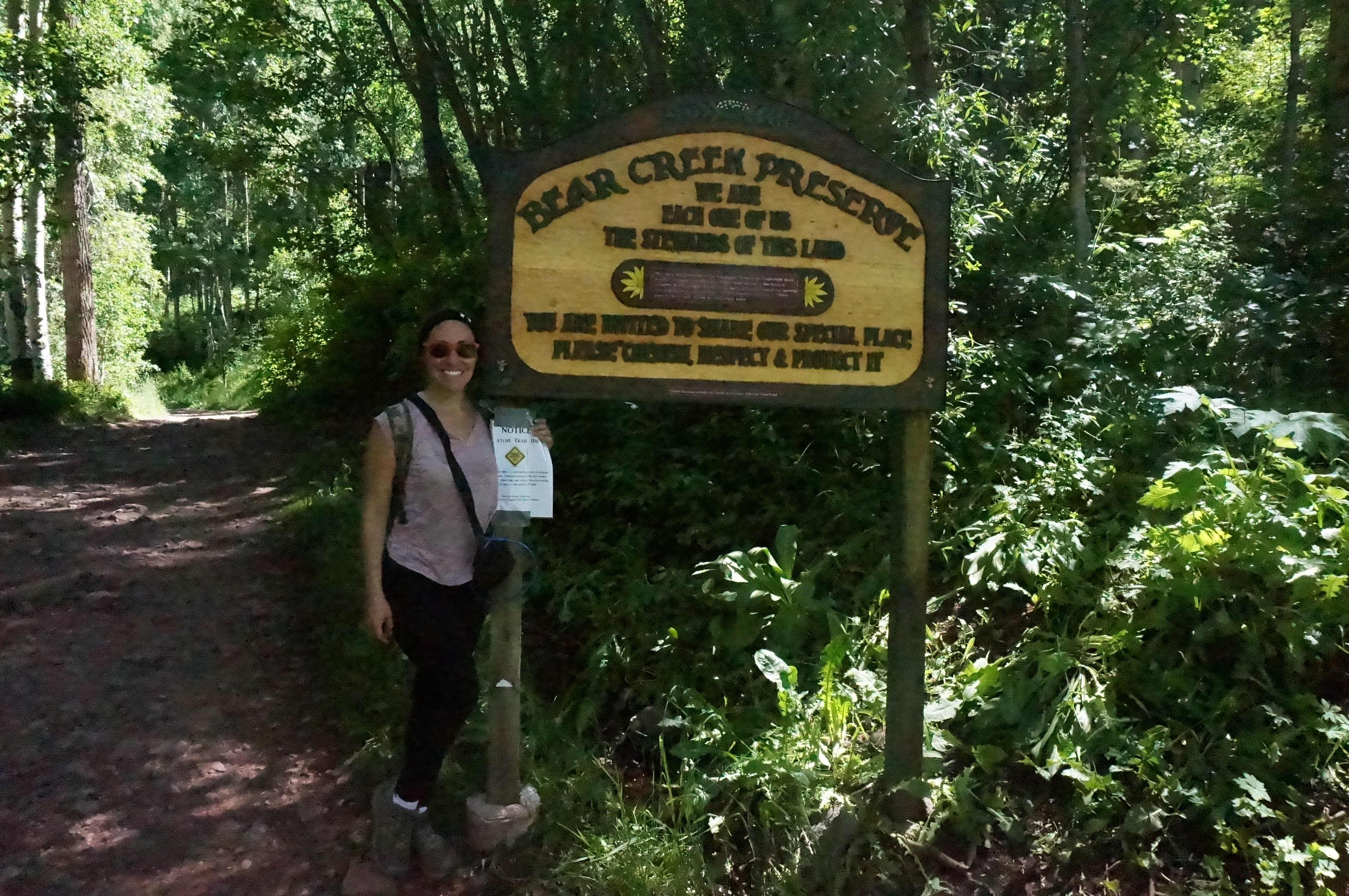
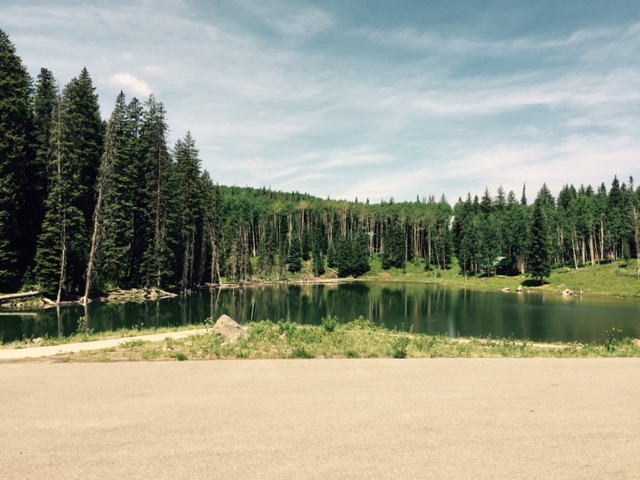
As with the last camping trip, we had no reservations and relied on blogs and the National Parks Service site for scant information on camping options.  That said, we were optimistic that there would be scattered campsites along the way.

After about 20 minutes ascending the super rocky road at about 2mph we met a guy hiking in the opposite direction with his kids.  We were weary from battling the terrain and were hoping he would tell us the illicit campsites we’ve read all about were just around the bend.  Well, no.  We’ve got at least another 3-4 miles, BUT there is a georgous meadow surrounded by peaks just by the creek with tons of campsites.  So with that, we were reinvigorated and continued onward.

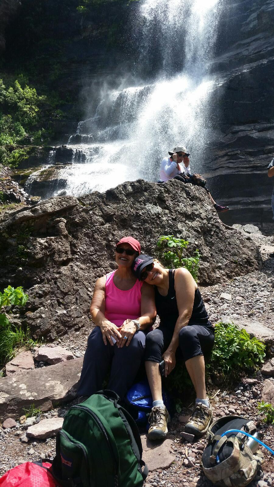
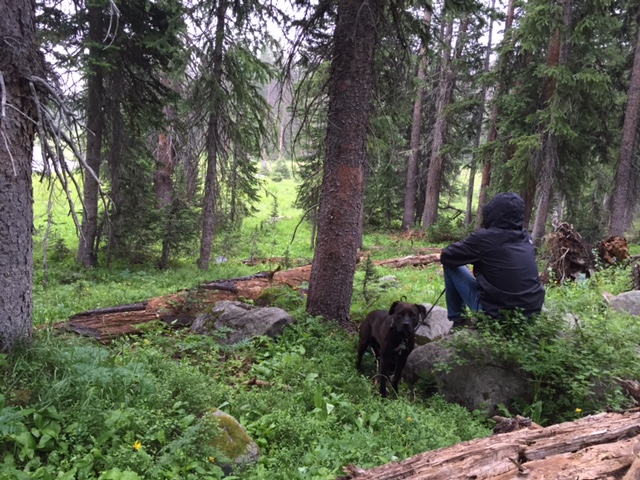
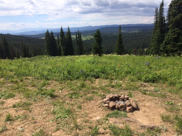
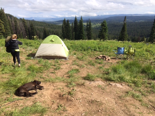
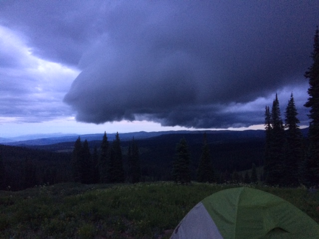
The campsite images tell it all folks.  It was worth it.

Baldwin - Camping - 2

Baldwin - Camping - 1

Baldwin - Camping - A&C

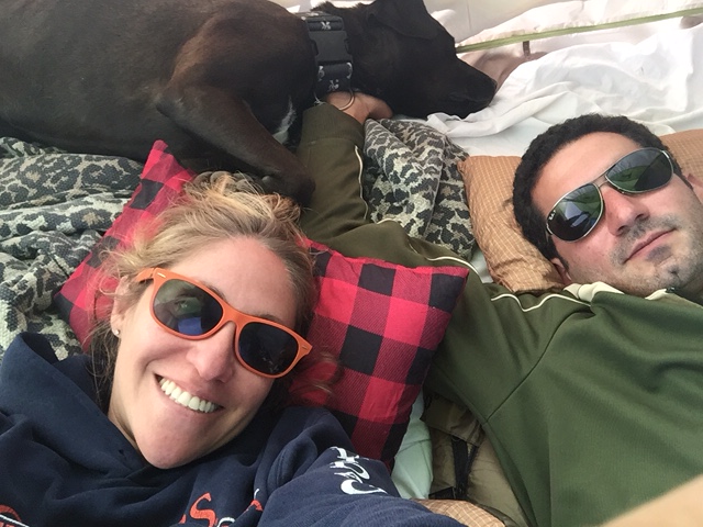
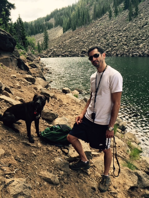
Our next challenge was dealing with the mosquitoes.  Those little bastards have been a thorn in our side everywhere we’ve gone, but this area was plagued by them; we are assuming the proximity to Baldwin Creek (which was crystal clear and beautiful) was the culprit.  BUT we got through it; once we got the fire going they calmed down.  It was a great evening.

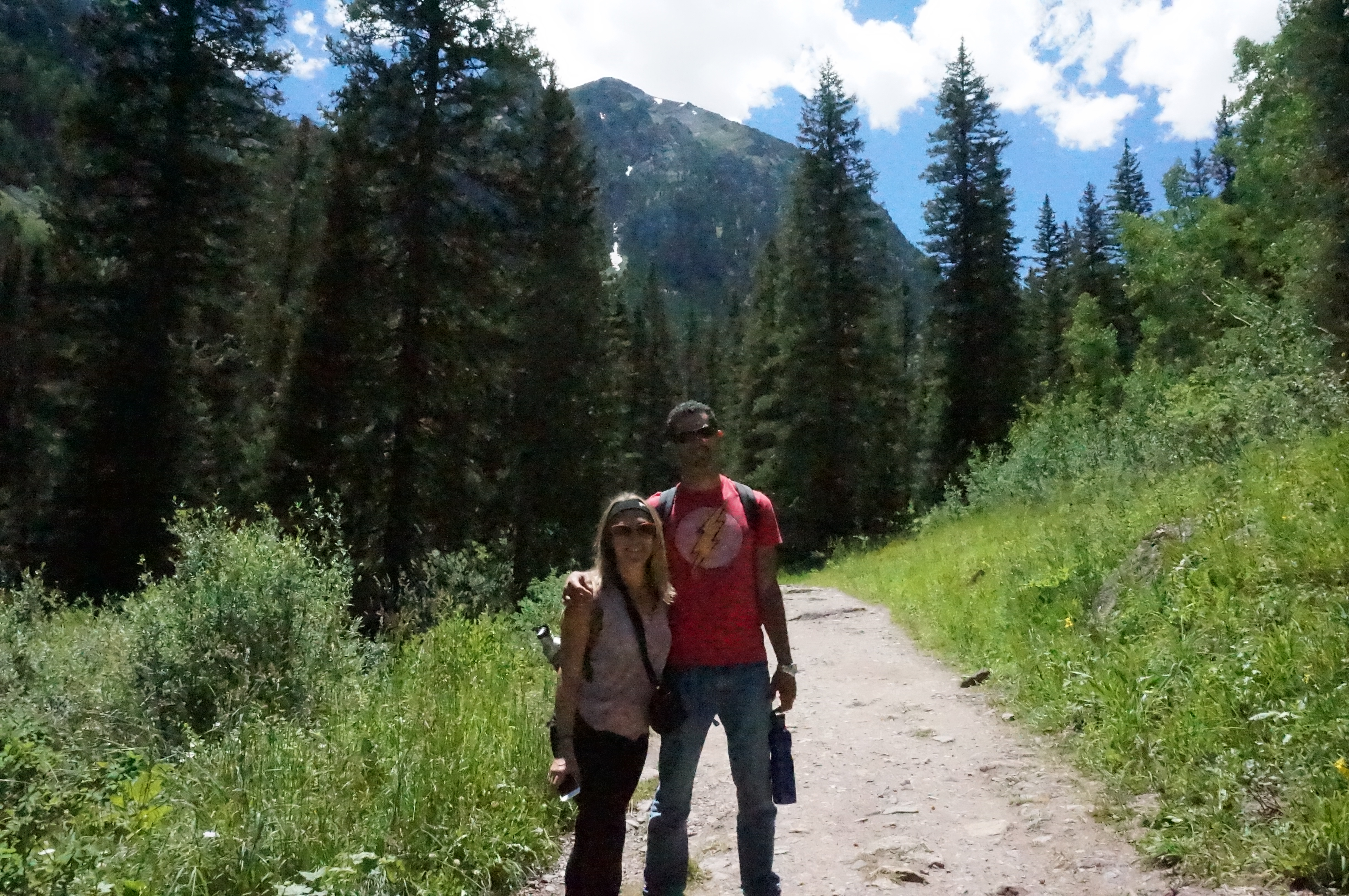
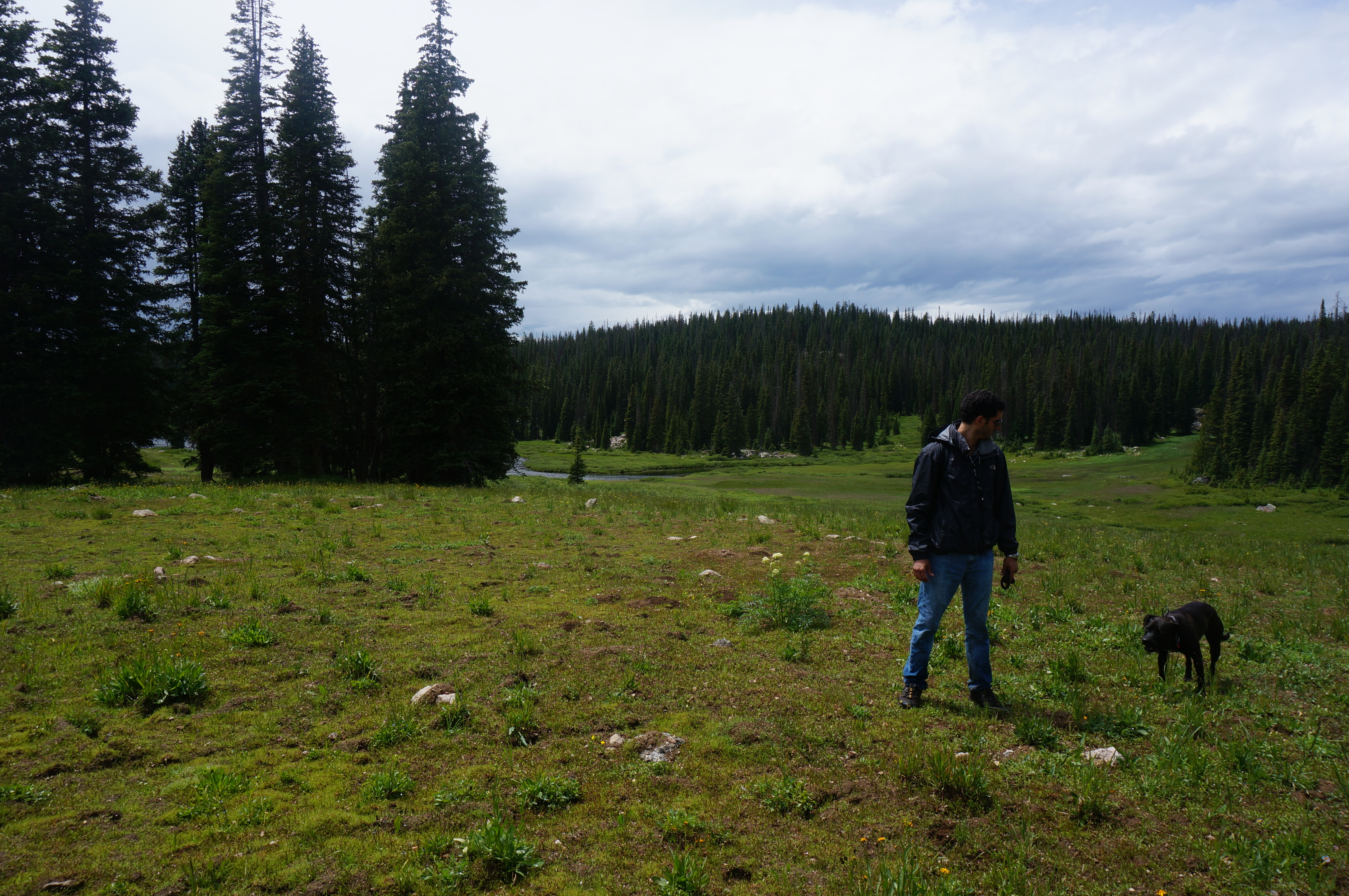
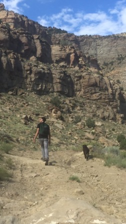
We all woke up early next morning, grubbed up and got ready to hike.  I never got a good sense for how far Baldwin Lake was from the campsite area while planning, but we knew it was going to be a diesel hike with the steep and rocky trail.  Time to get your game-face on.

Baldwin - Hike Start - M

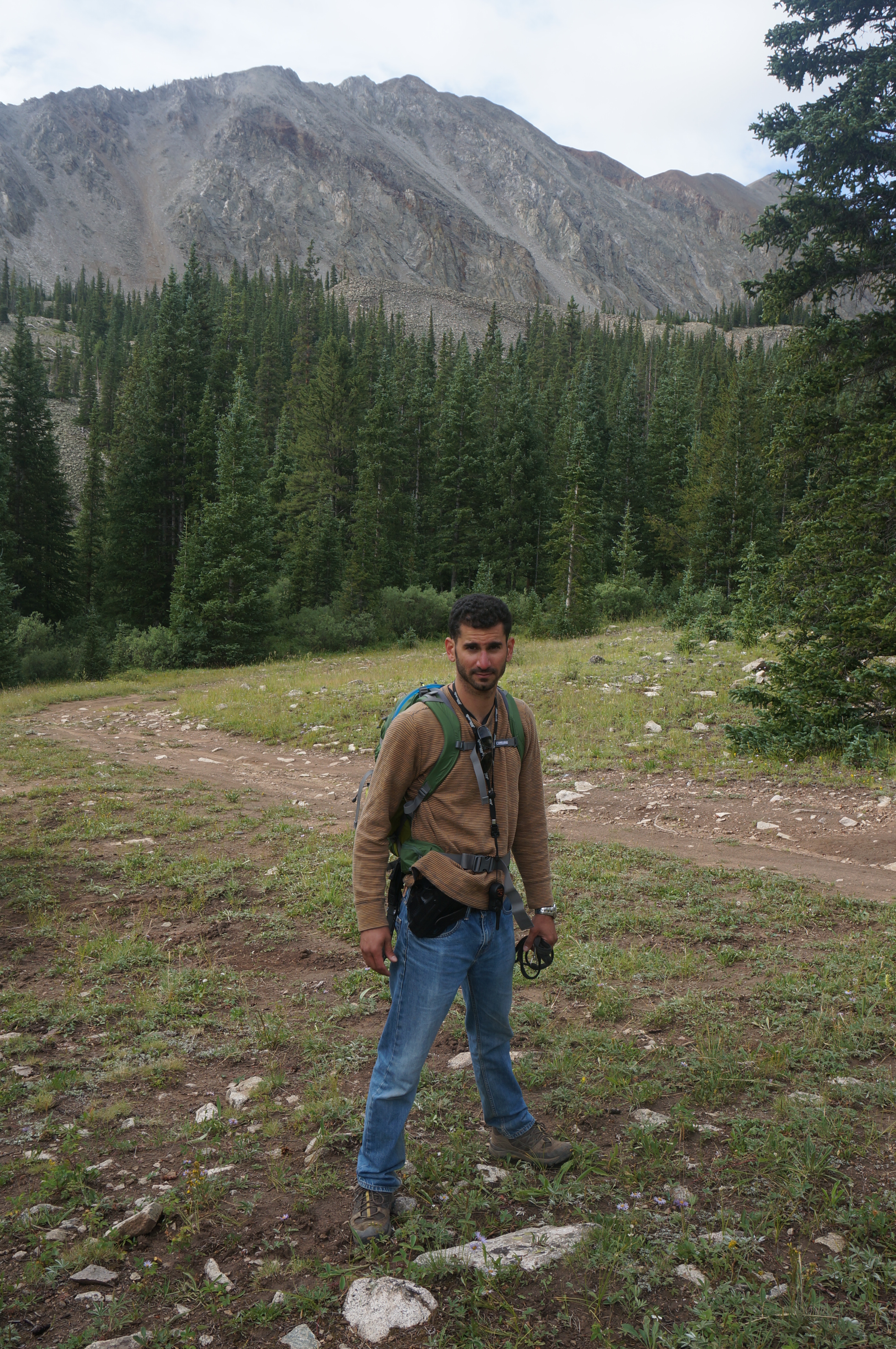
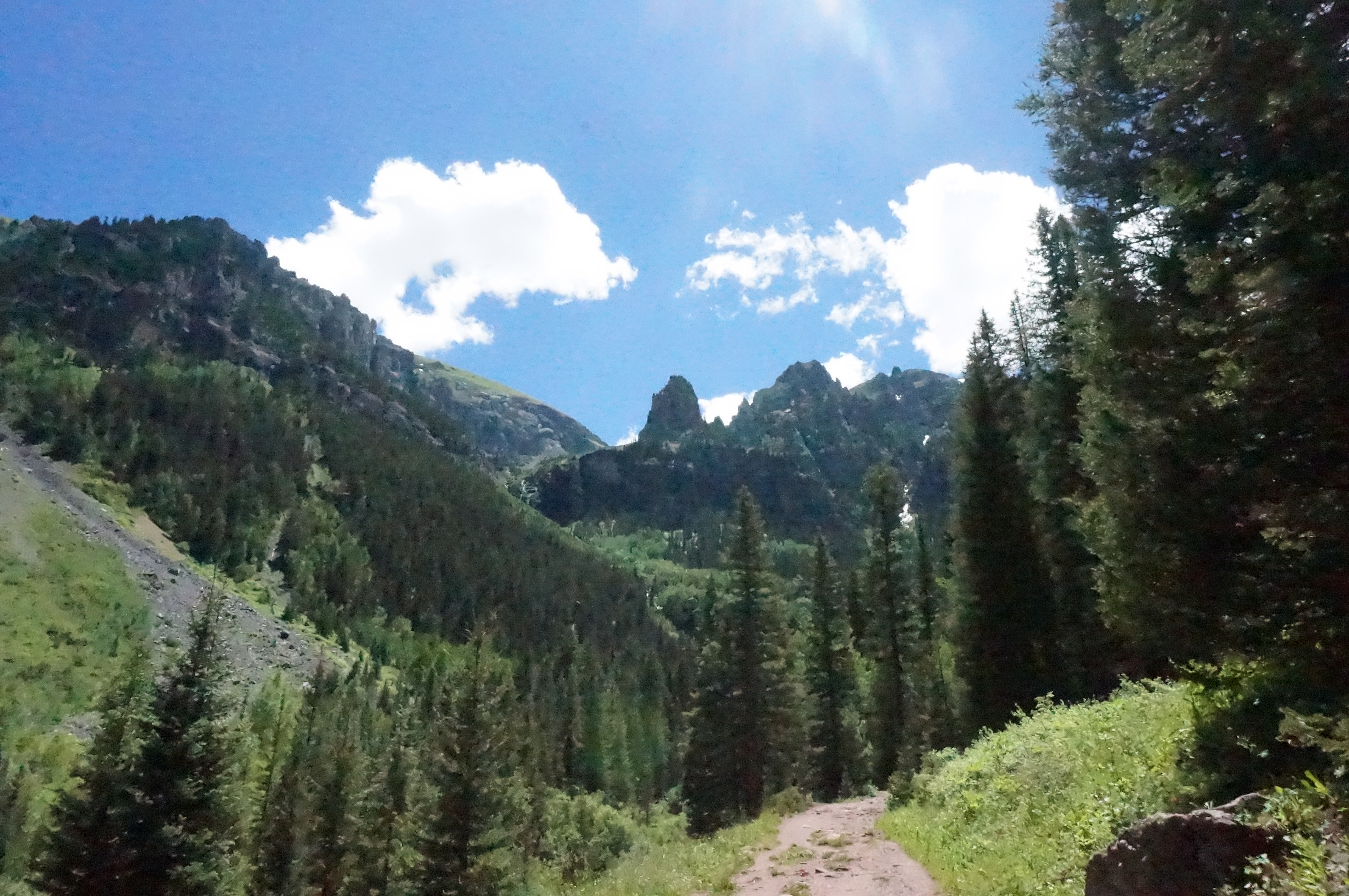
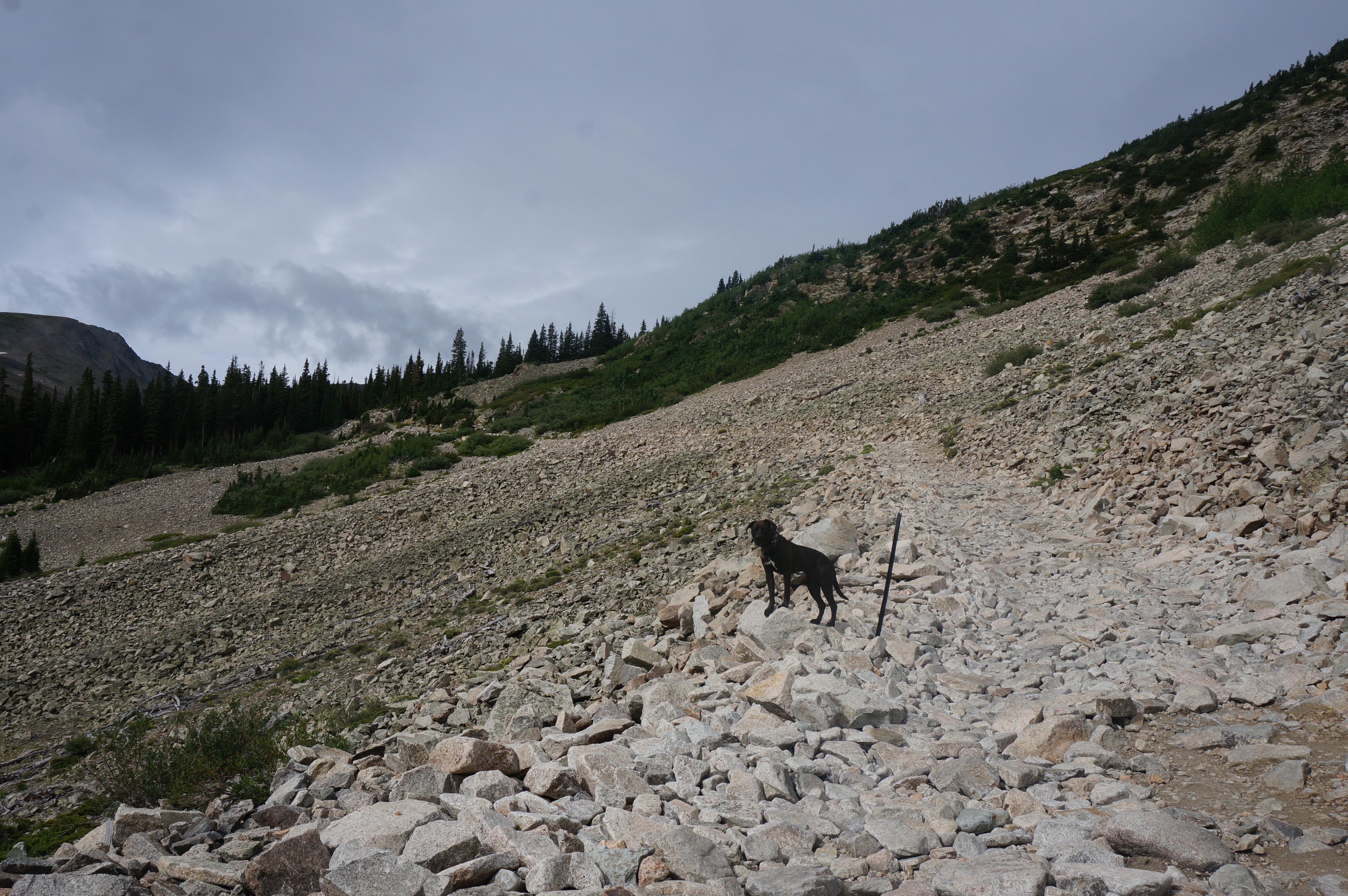
The first mile was super steep and we were gaining elevation fast – lot of huffing and puffing going on.  The trees obscured the distant views, so we didn’t see the full extent of what we were in for, but we were getting a good idea.  Again, we knew it would be a formidable hike and once we hit the clearing we got a good sense for was in store for us; it wasn’t a walk in the park.  No turning back now.

Baldwin - Hike - A&M

Baldwin - Hike - C

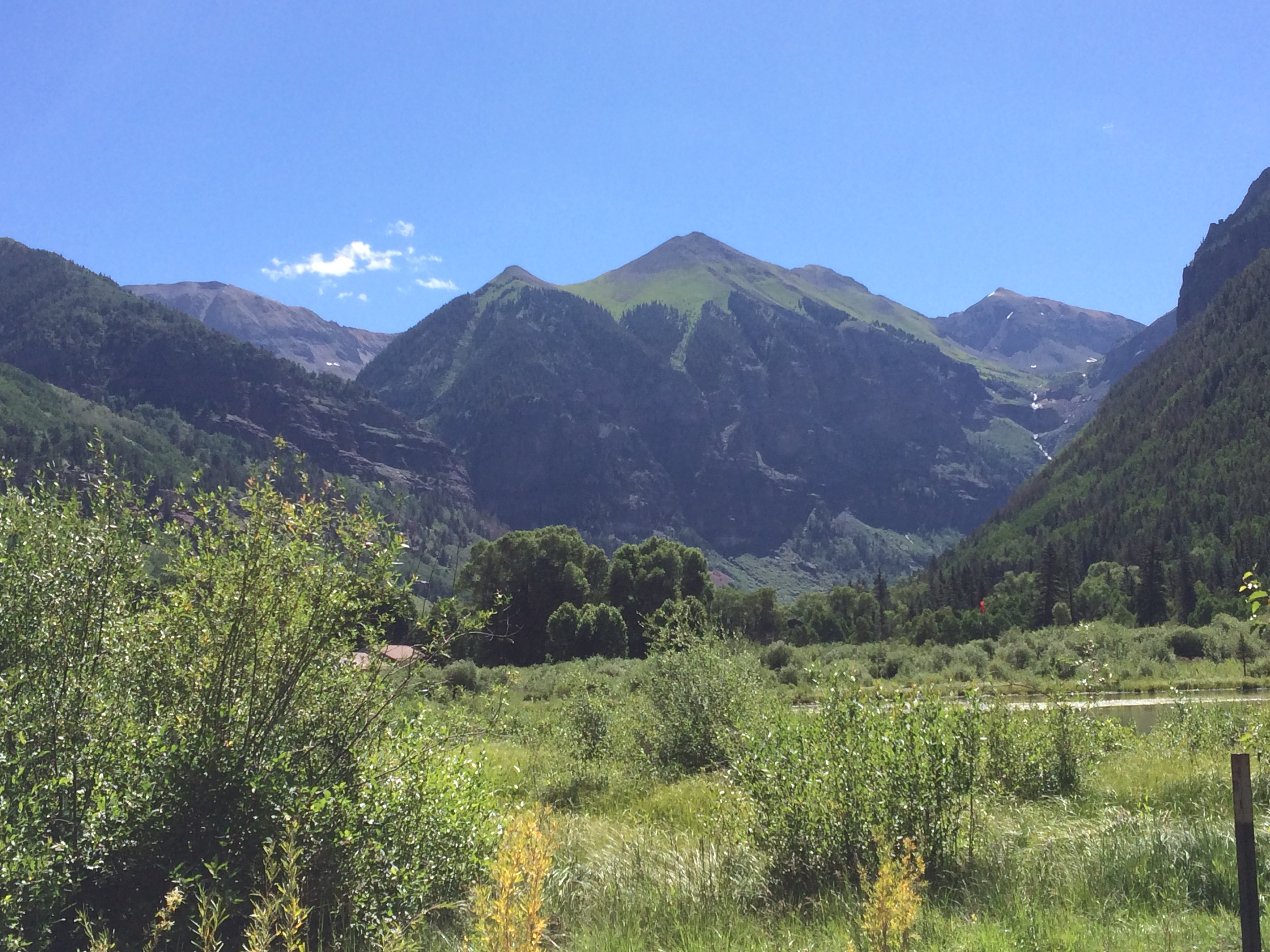
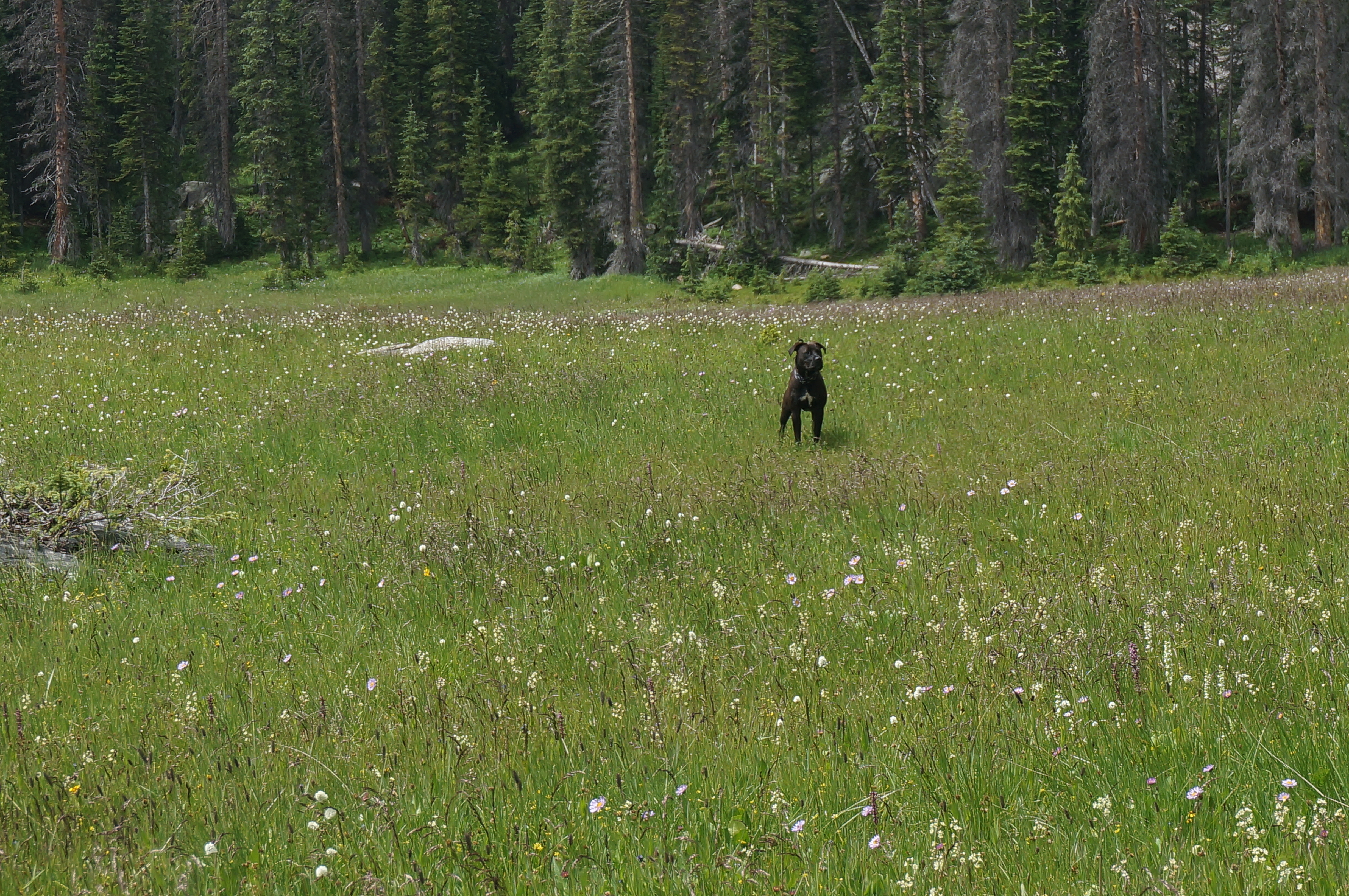
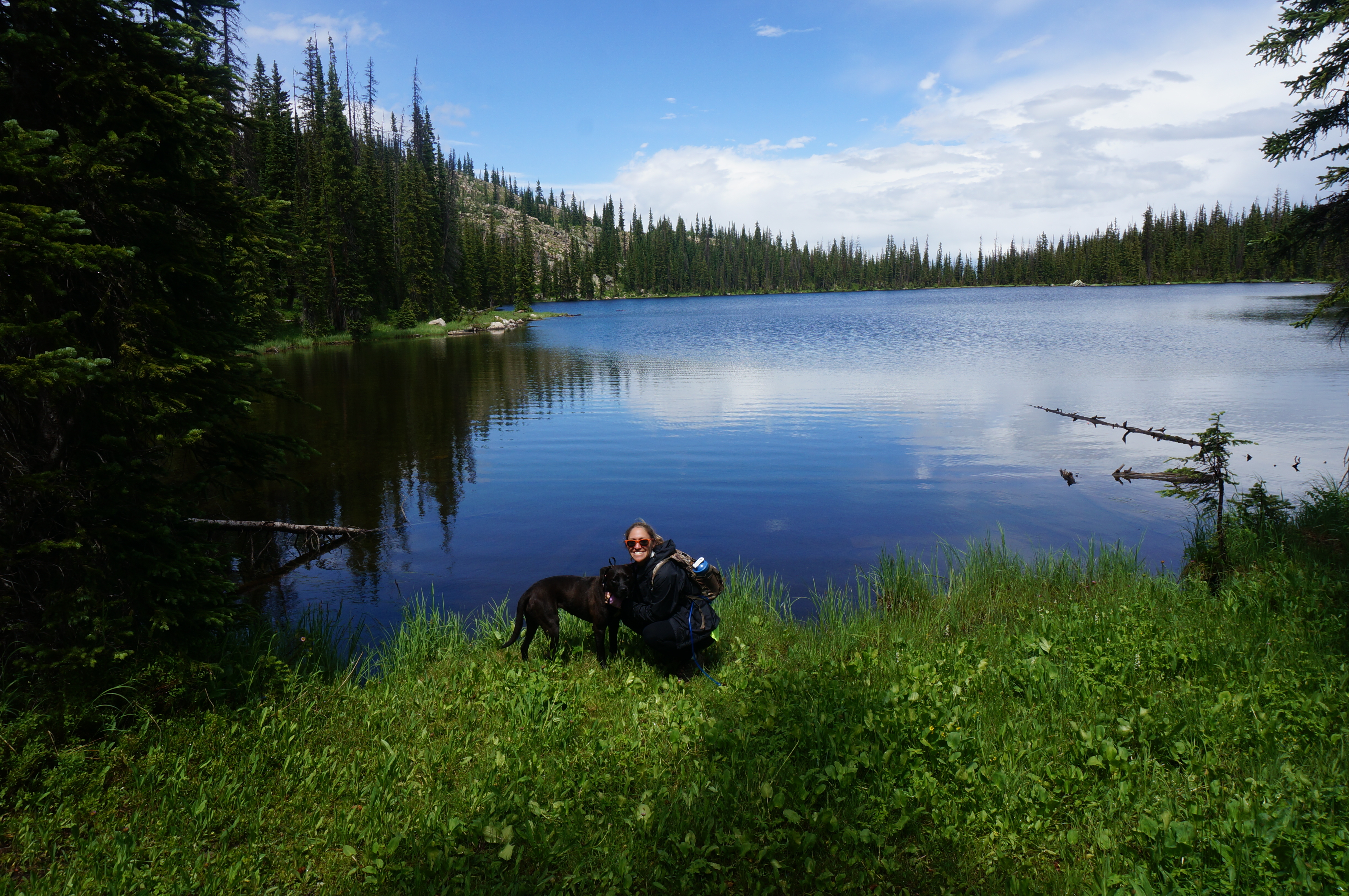
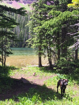
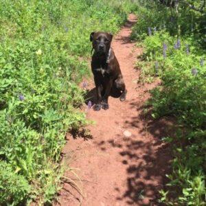
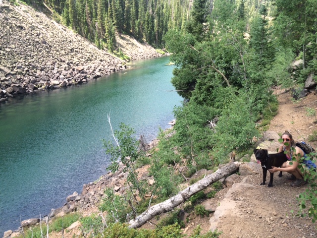
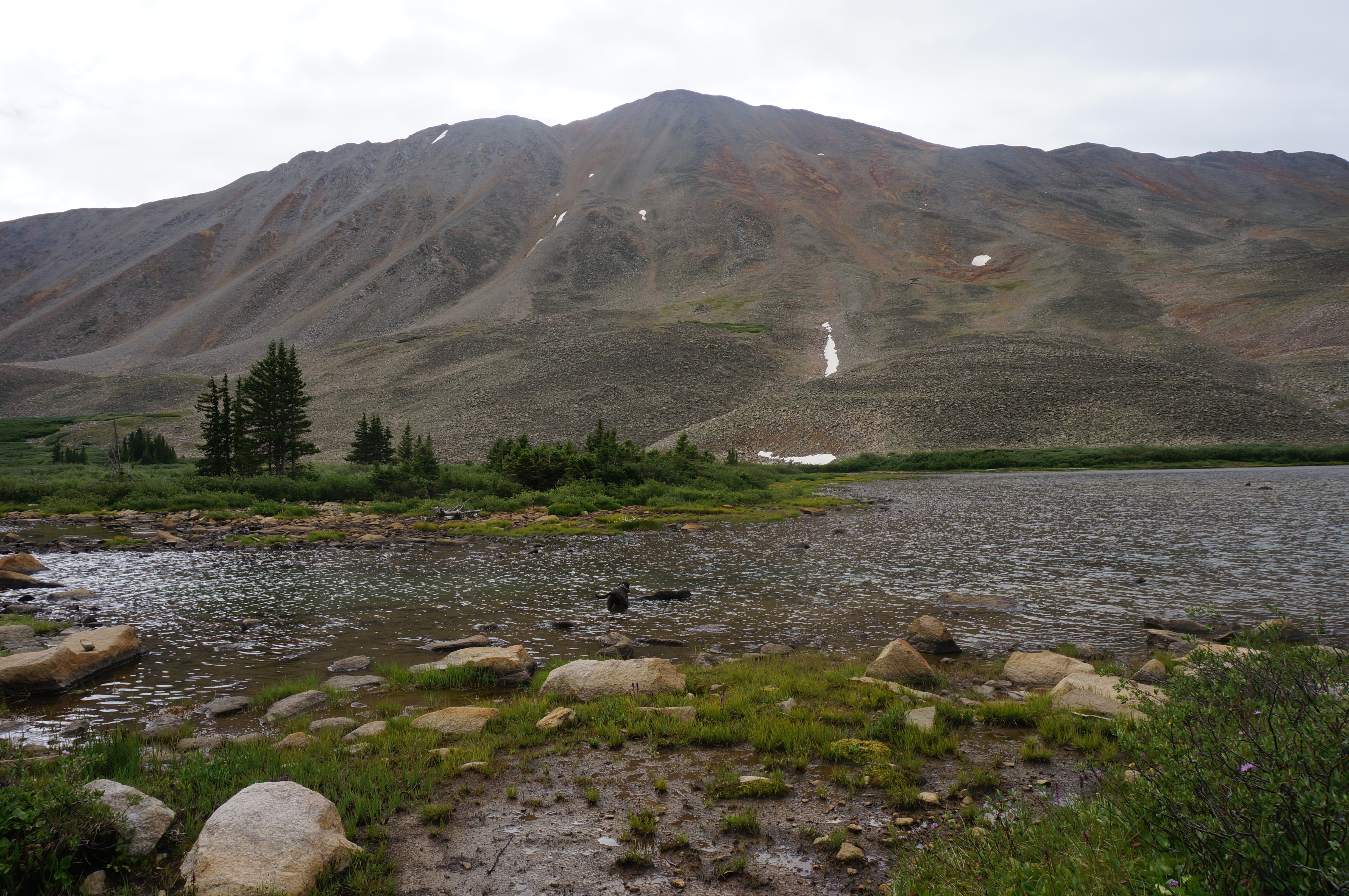
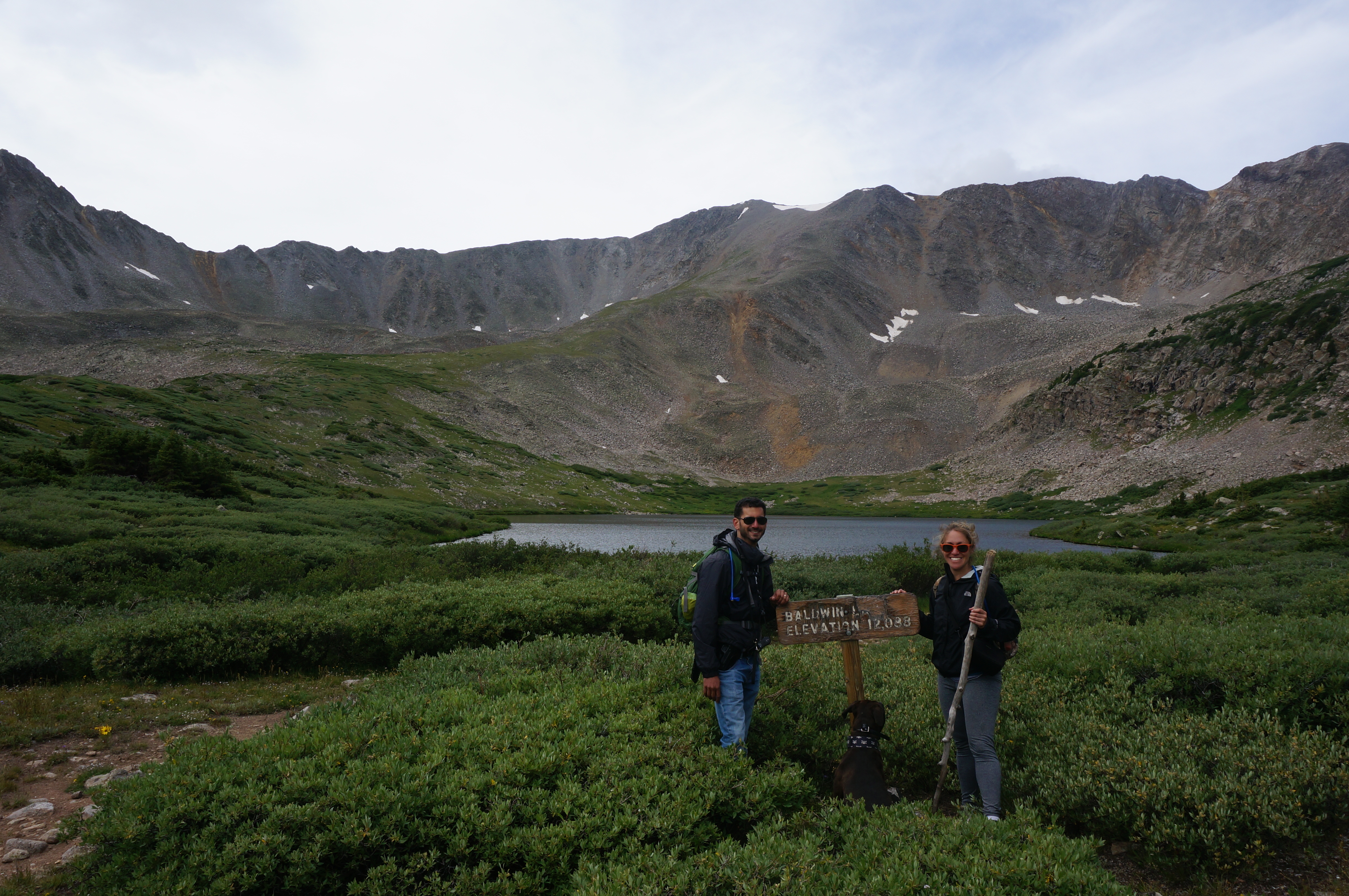
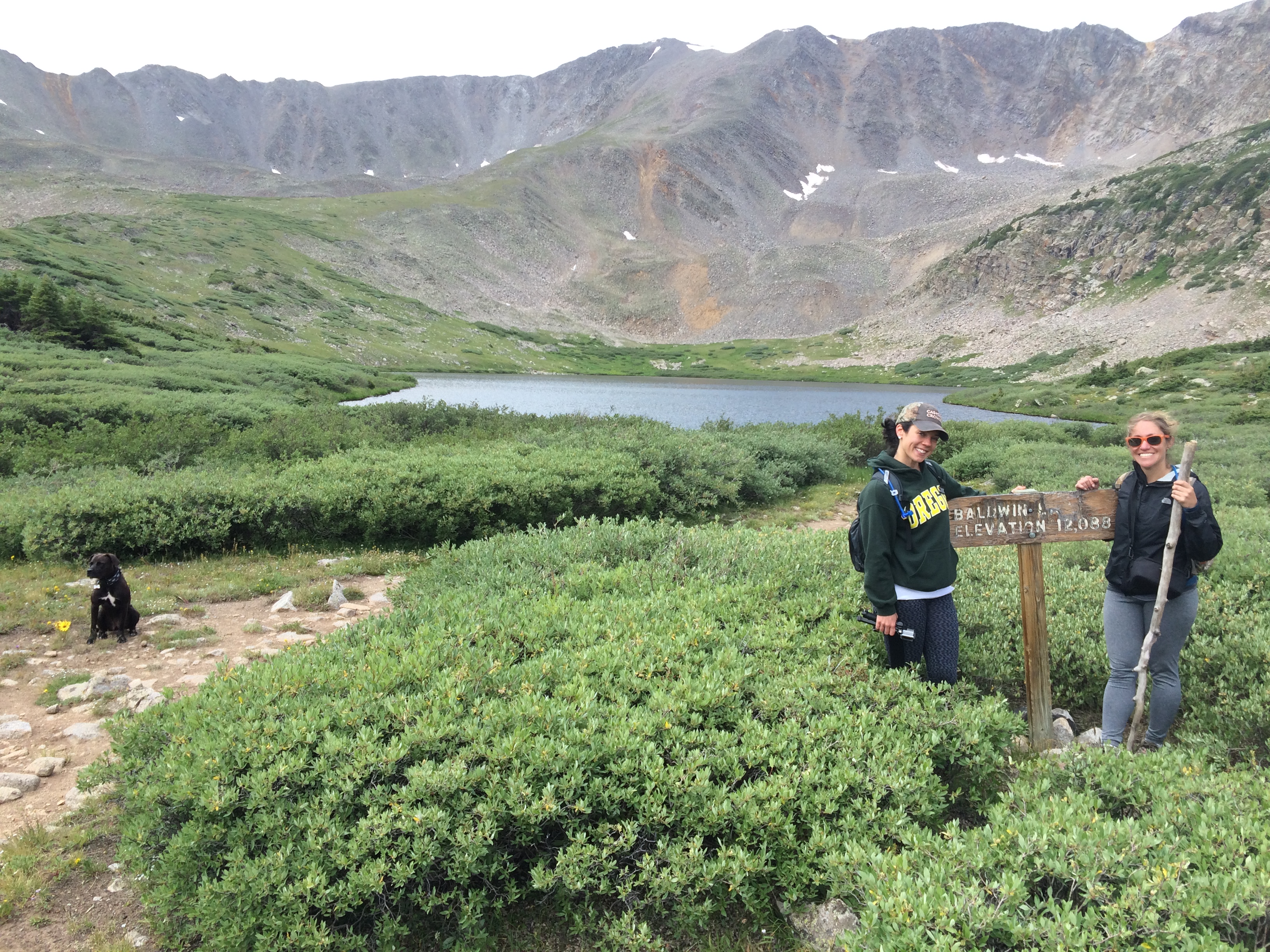
Baldwin Lake actually consists of two lakes that the snowmelt creates as it makes its way down the numerous mountains that surround the bodies of water.  We arrived at the first lake and it was gorgeous.  We stopped for a small snack and to take it all in; Chica even went for a dip.

Baldwin - Lake 1 - A&C

Baldwin - Lake 1 - A&M&C

Baldwin - Lake 1 - C

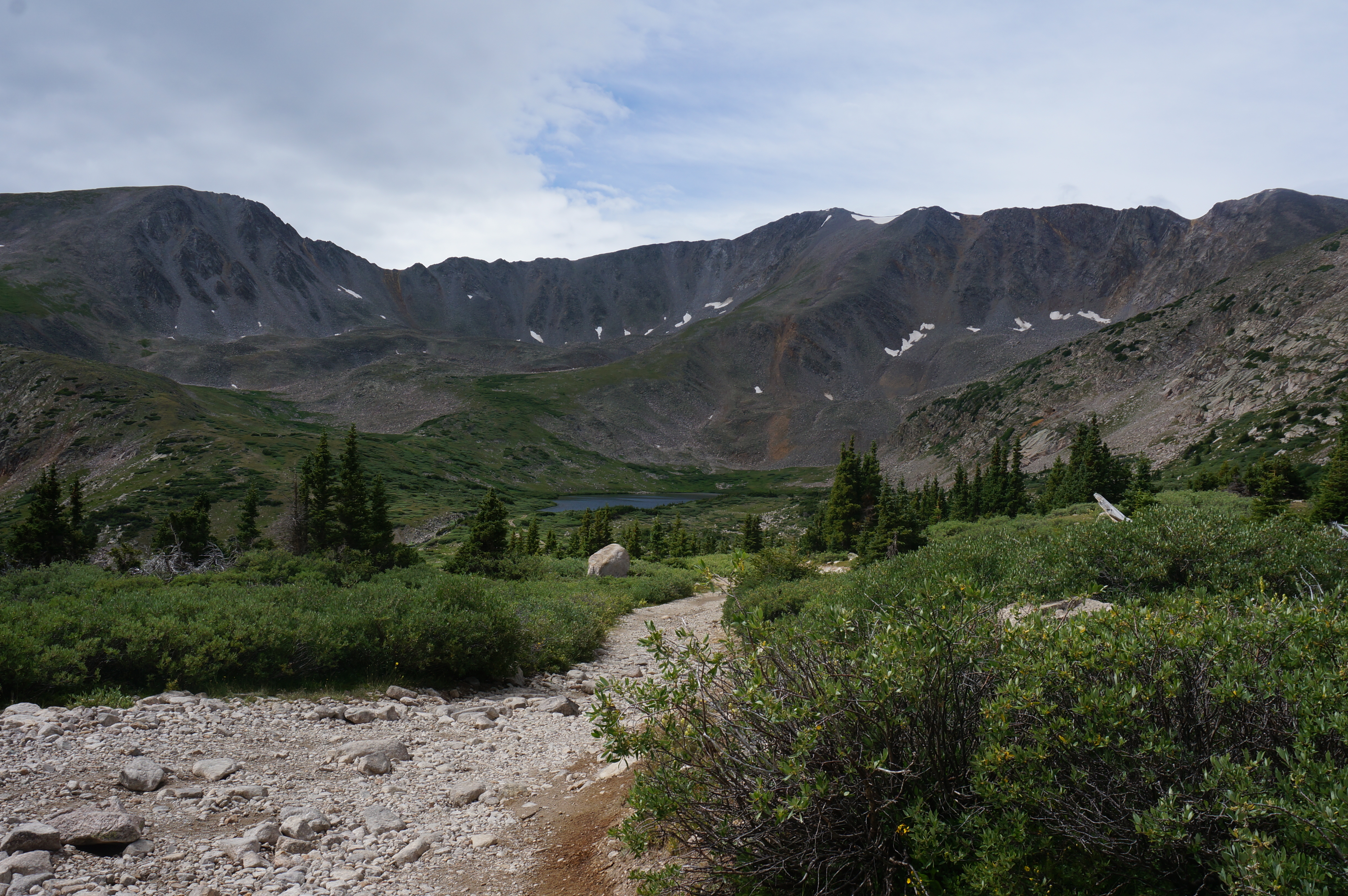
After a short rest and a dose of natural beauty we were invigorated and started off to the second lake.  But first, one more beautiful glimpse of Baldwin Lake 1.

Baldwin - Hike - M - after 1

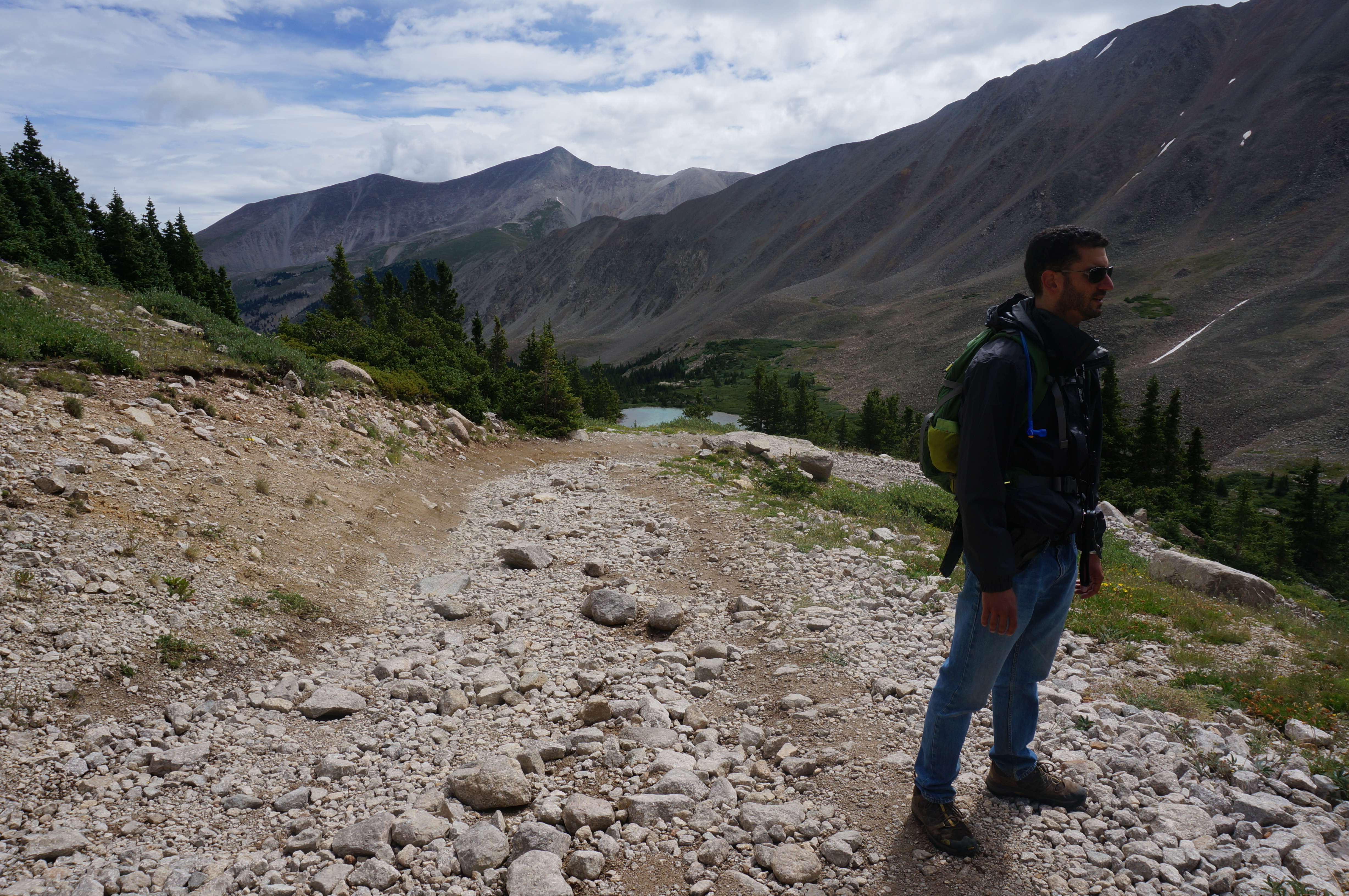
The hiking remains steep and rocky.  From looking at the map Baldwin Lake 2 wasn’t that far from the first lake, yet it felt like we were walking for a while.  Well we were walking too long.  We passed the unmarked and very inconspicuous switchback on the trail that leads to Baldwin Lake 2.  We realized this when we saw Baldwin Lake 2 in the distance – under us.

Baldwin - Passing

Baldwin - Passing 2

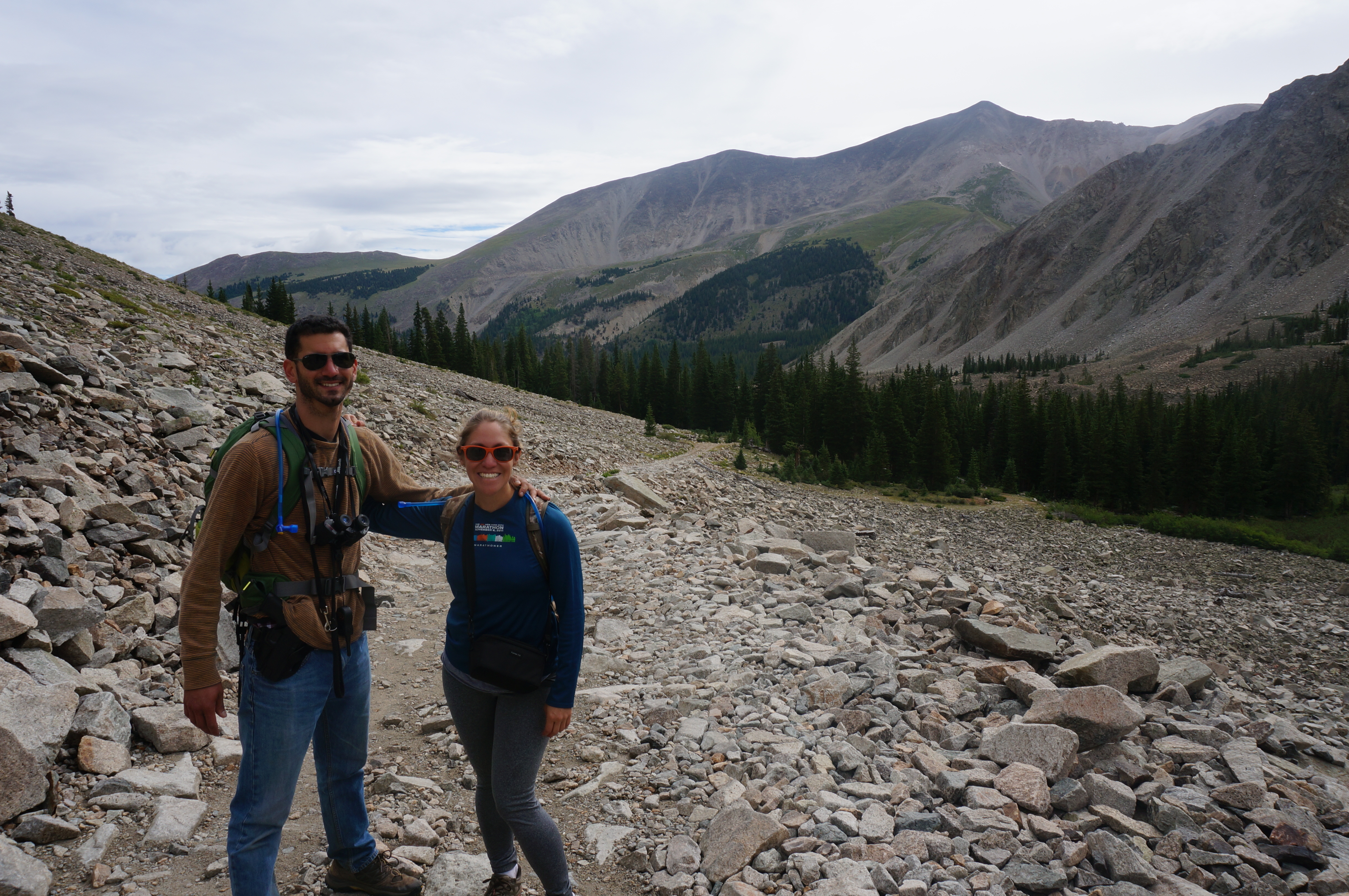
Well we decided to hike a little more to see if there was anything interesting ahead and realized: the more we go up the more time we spend going back down.  So we double backed and hit the switch back taking us to the lake.
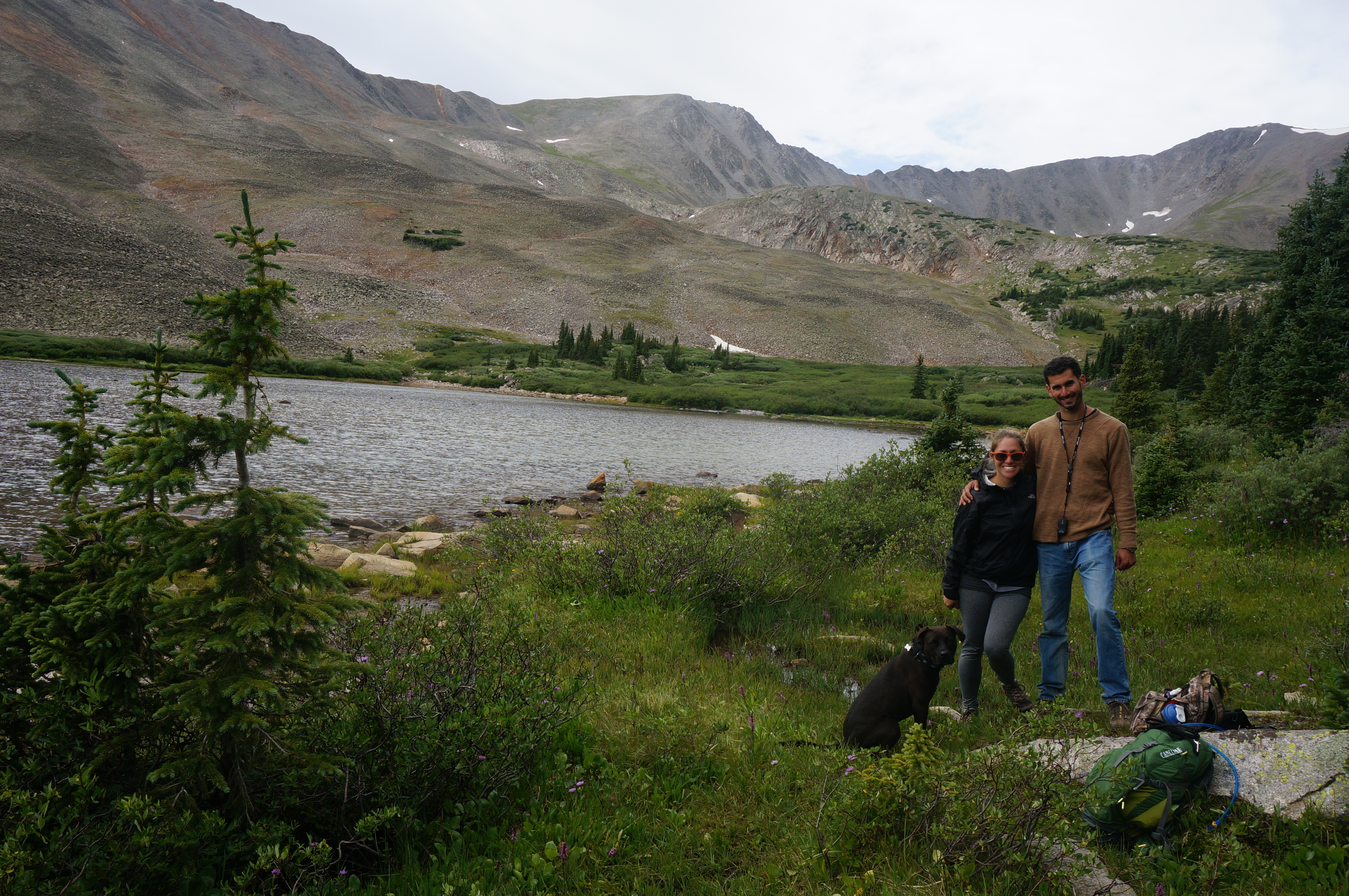
We’ve arrived!

Baldwin - Lake 2 - Arriving A&M

Baldwin - Lake 2 - Arriving A&C&C
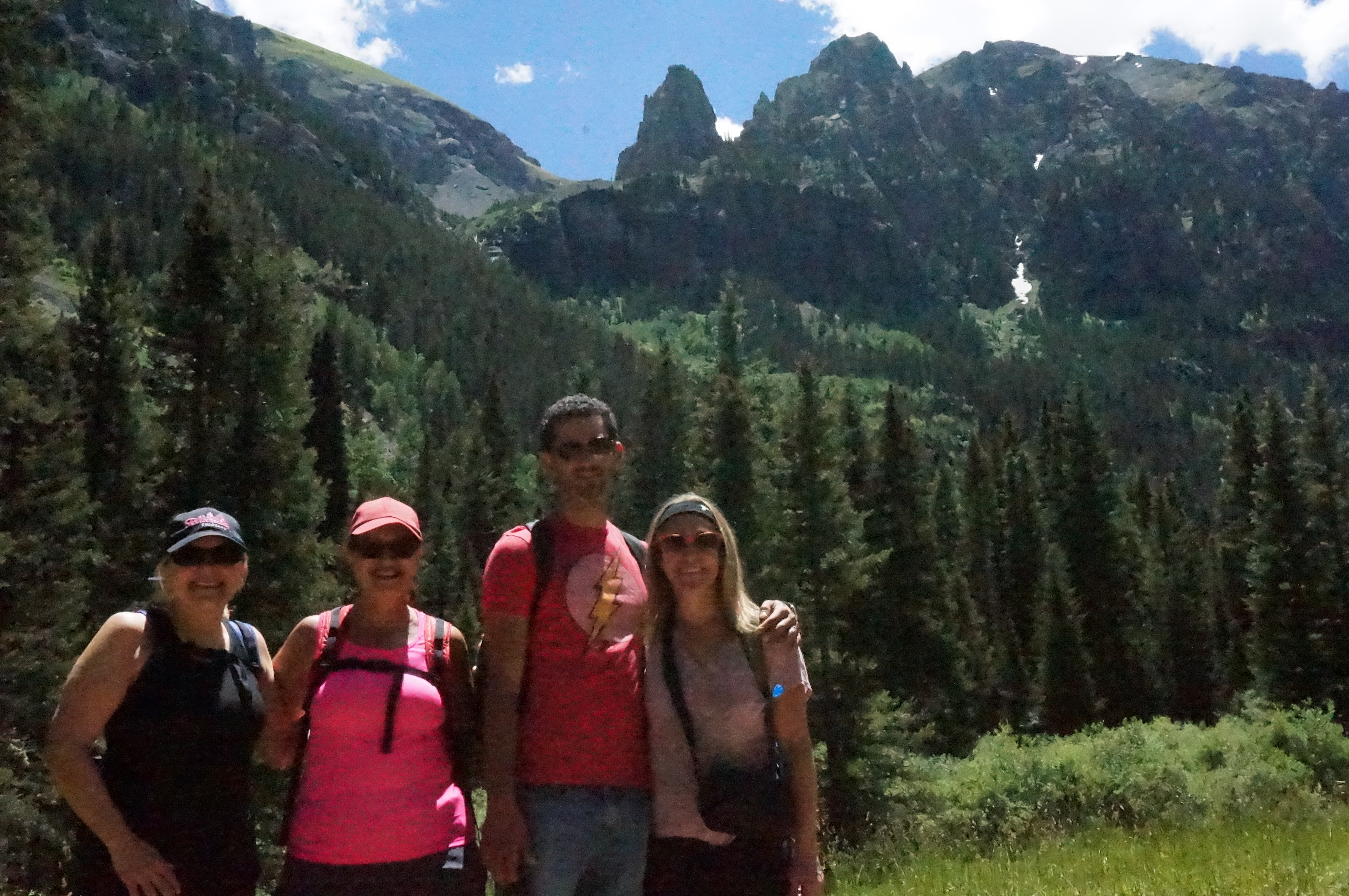
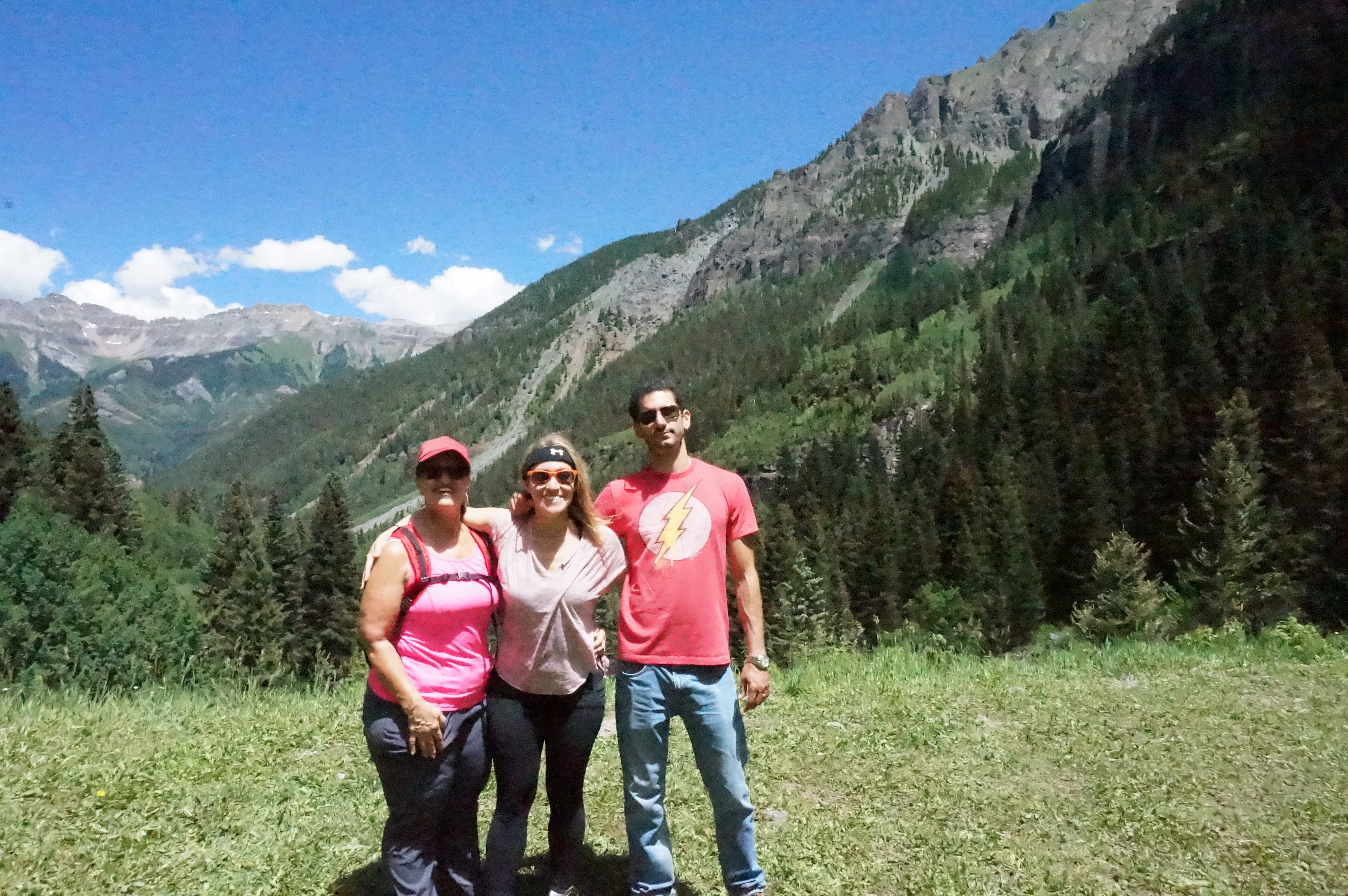
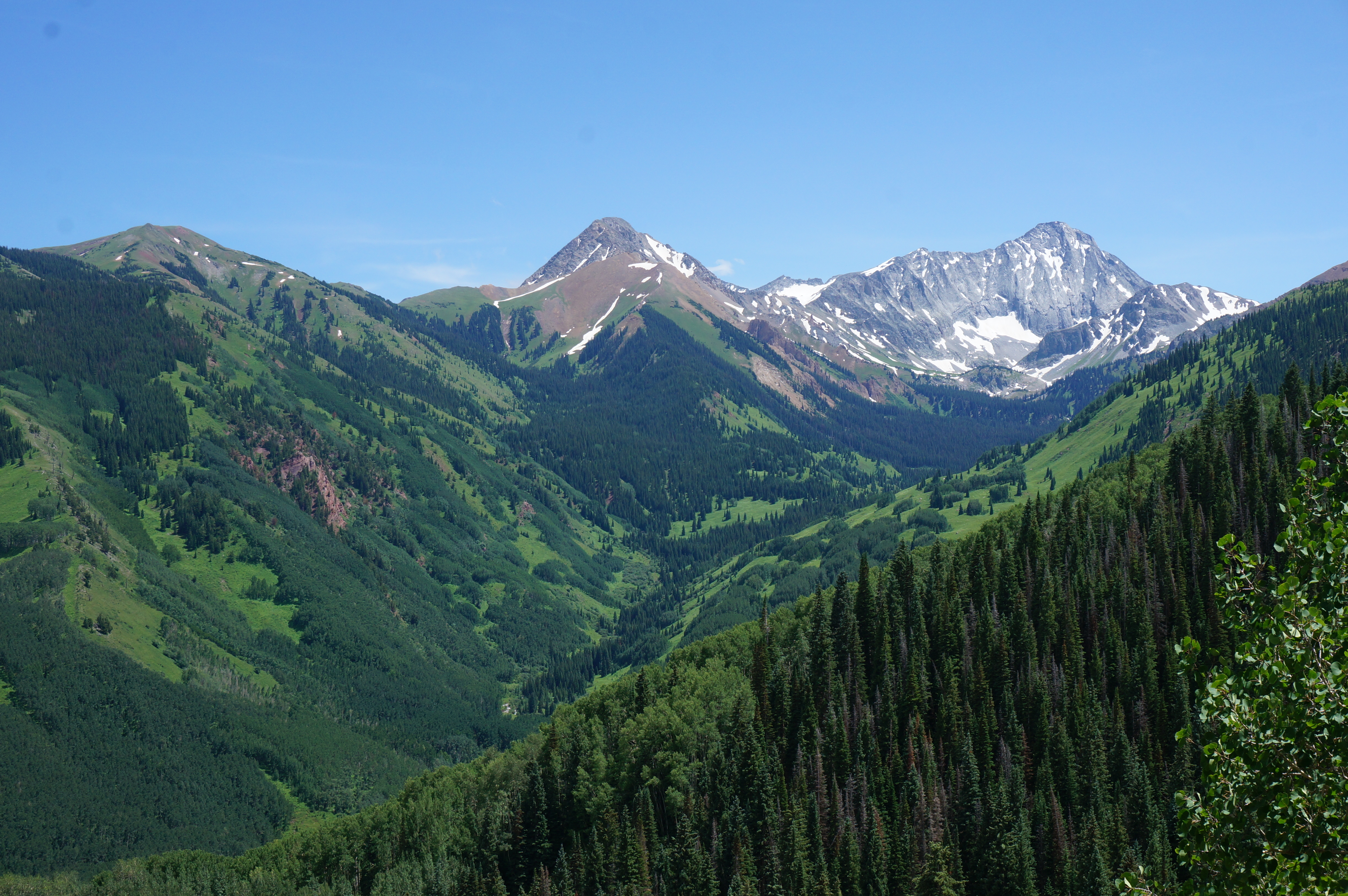
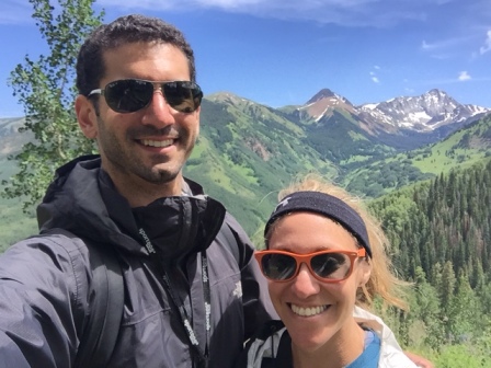
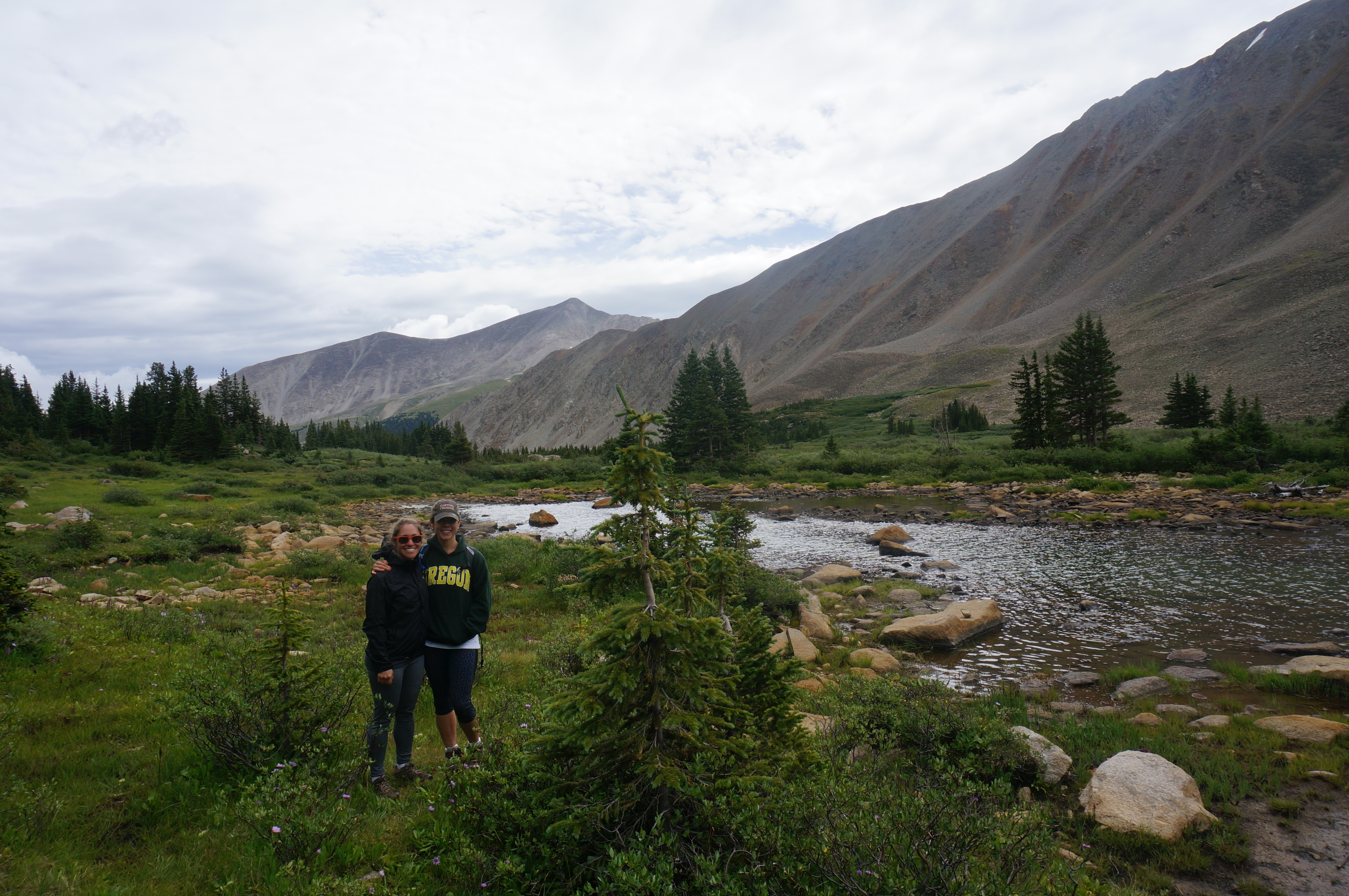
Across the lake there was a big grassy patch at the base of the mountains.  The view from there had to be spectacular and we decided to trek a little more (bringing us to the picture at the top of the entry) and post up for lunch.

Baldwin - Lunch 1

Baldwin - Lunch 2

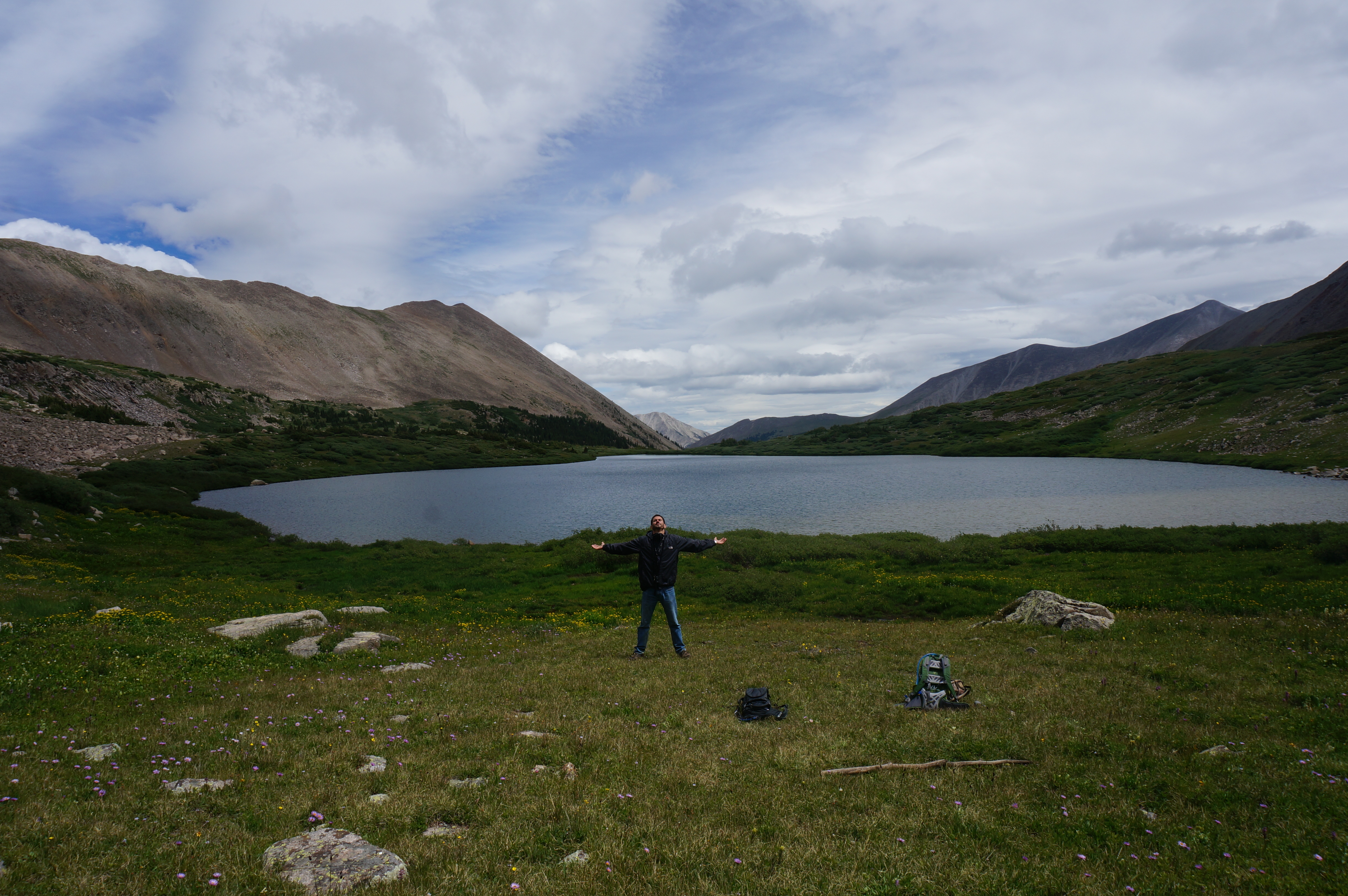
We are surrounded by 5 mountains listed clockwise: Boulder Mountain, Mt. Antero, Cronin Peak, Grizzly Mountain, Mt. Momma

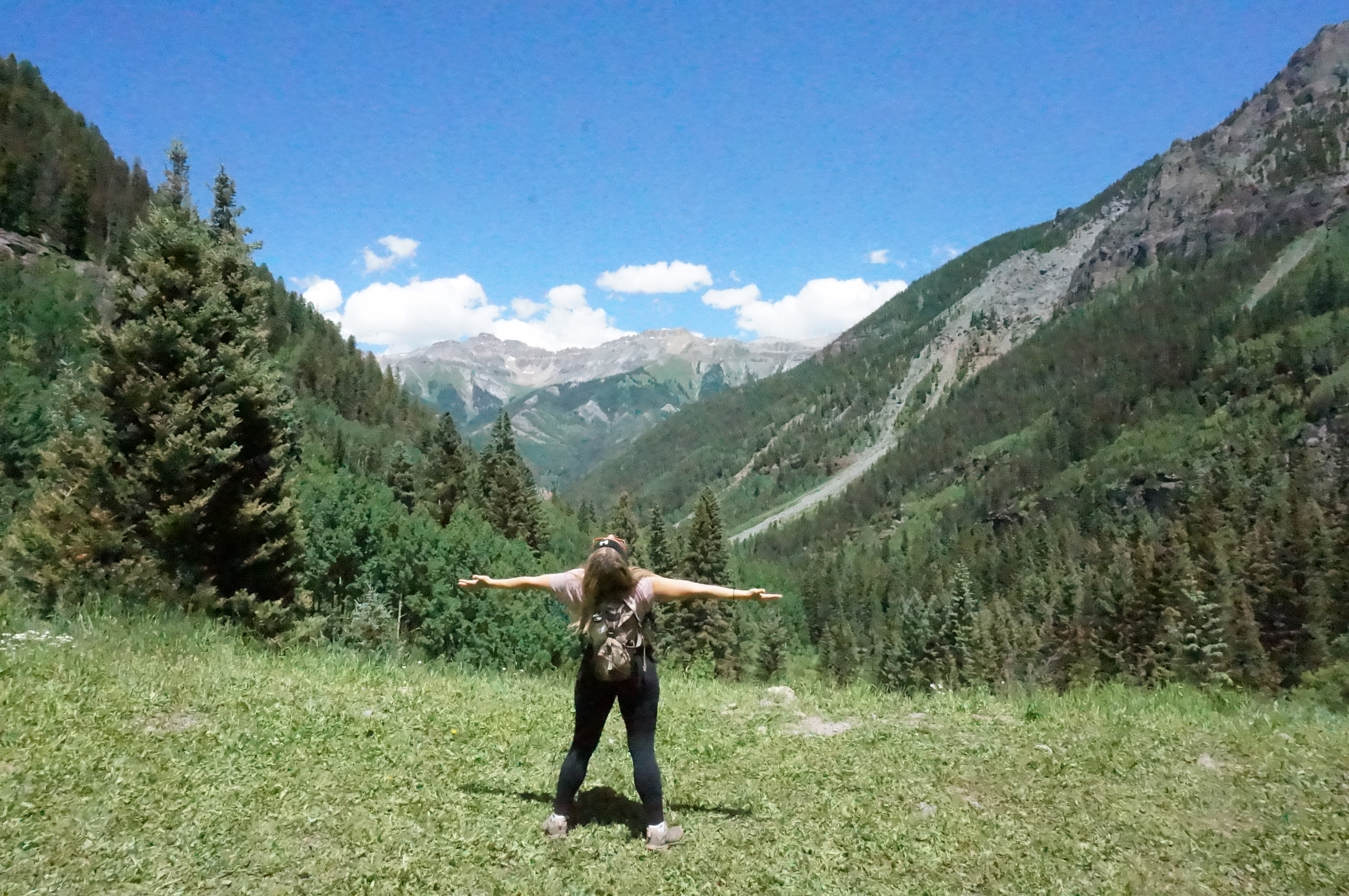
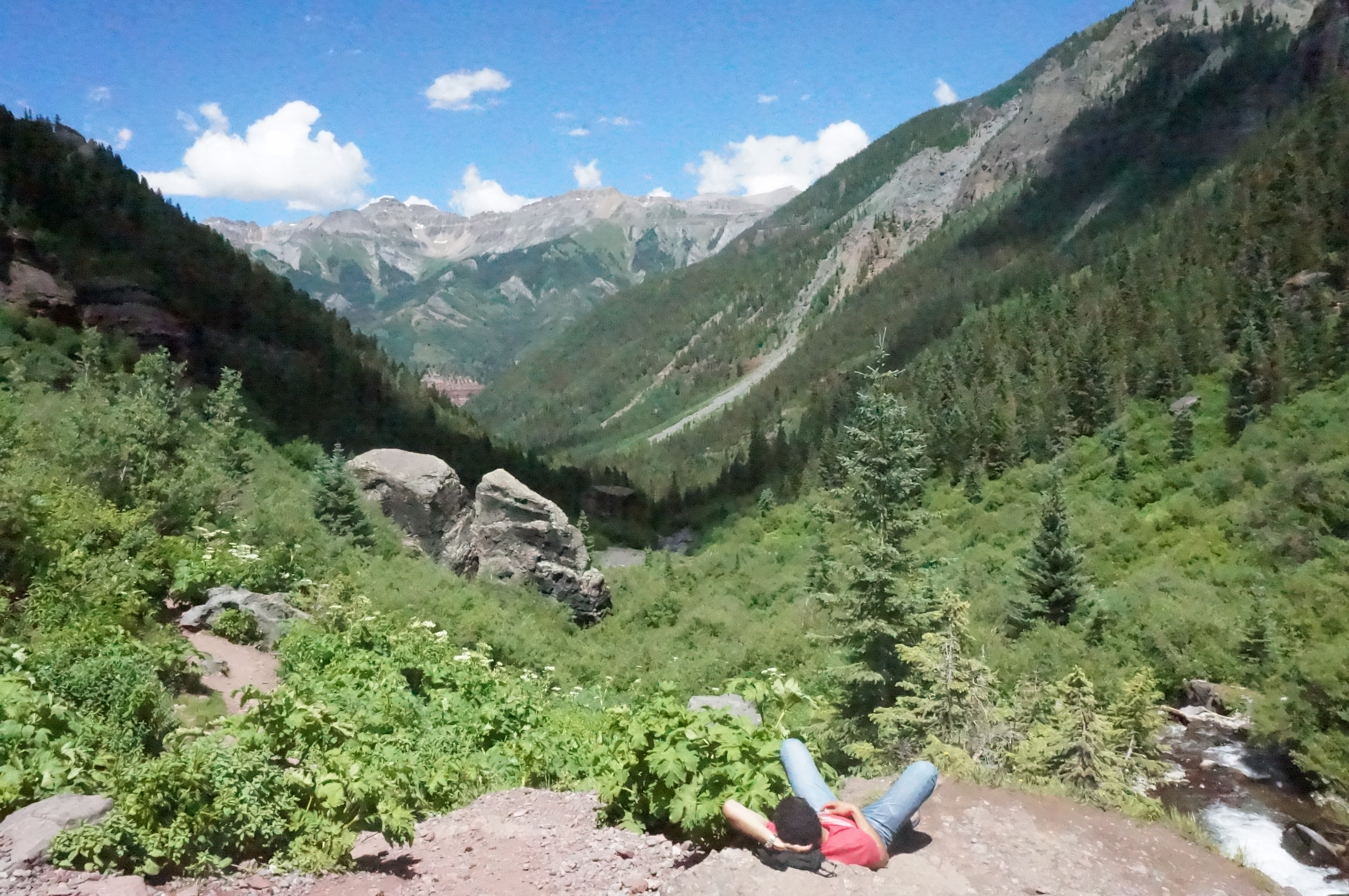
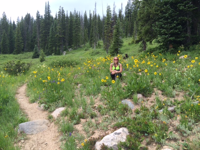
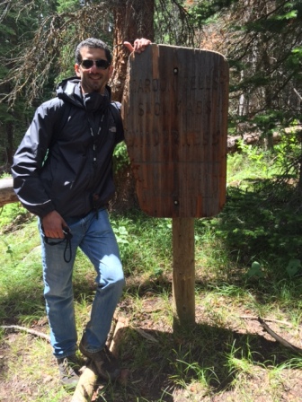
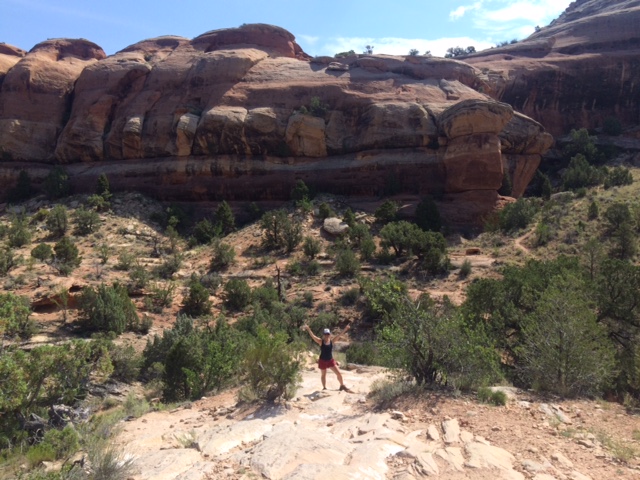
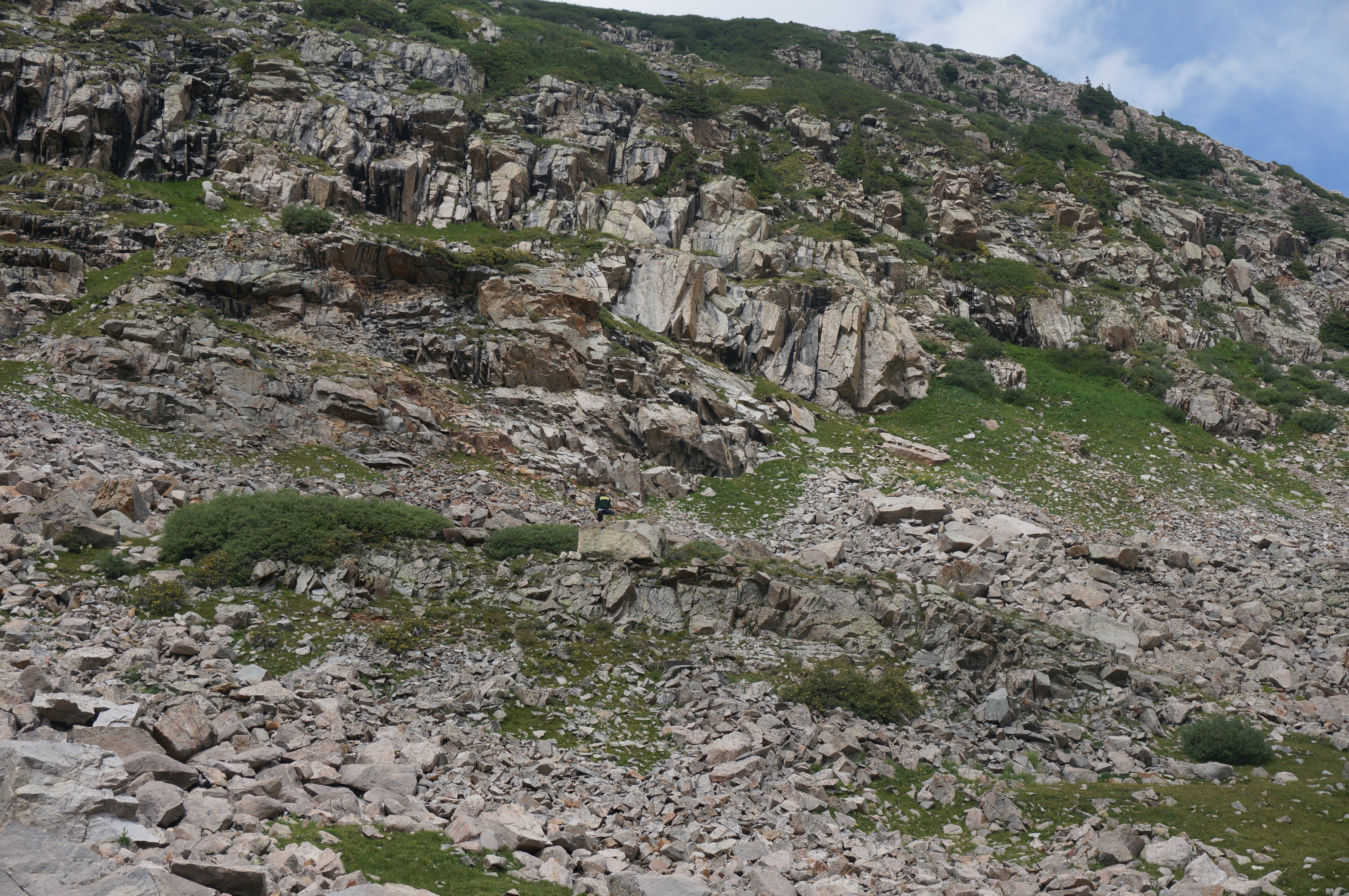
Christina was ambitious and went the extra distance for this awesome photo op.  Can you see her?

Baldwin - Cmart - Climb

After some time refueling and taking it all in we headed back to camp.  Yeahh no gondola taking us down this mountain.

Baldwin - Hike Down

We decided mid hike that since it was still relatively early in the day, we would pack up and head home to Palisade rather than spend another night.  We’d have a full day the next day to do as we pleased rather than waste it driving home.  Everybody was pooped.

Baldwin - Ride Home

Colorado National Monument

So, we have another visitor!  Christina came through ready to put in some hiking.  Being such an outdoorsy destination it’s great when someone arrives game for anything.

There is a camping trip planned for the weekend, but we had to get our guest to the National Monument; it’s so close and too beautiful not to!

CO NTL - Monument

This is the actual monument where they raise the US flag every July 4 since John Otto started this tradition in 1911. (Source)

There are two entrances to the park, Grand Junction and Fruita.  Junction (as the locals call it) is the closer choice, but we decided to check out Fruita’s little town for a bite to eat before exploring the park.

As soon as you drive through the entrance the scenery is unreal.

CO NTL - Ascending

CO NTL - Arrival

The park is surrounded by Rim Rock Drive; a 40 mile loop taking you to overlooks and trailheads.  We took the western part of the loop coming in from the Fruita entrance – about 23 miles – so we would have more options of views and short trails to check out.  Some of the places we stopped:

Alcove Nature Trail – ½ mile round trip

CO NTL - A&C Alcove nature box canyon

The trail hits a dead end and you realize it’s over

Otto’s Trail – ¾ mile round trip

CO NTL - A&C Otto Trail Entry

CO NTL - Monument

As mentioned above, John Otto was the crazy bastard that climbed 450 ft. to hang the nations flag atop this beautiful rock in the center.  But that is not his biggest accomplishment.  When he stumbled across these Red Rock Canyons in 1906, Otto lobbied successfully to make this place a National Park.  Thanks John! (Source)

Coke Oven Trail (unsuccessful)

The signage wasn’t too clear and we thought the trail started at the overlook point.

CO NTL - Coke Oven Overlook

It didn’t and instead we ended up off the trail and in a cave.

CO NTL - M - Cave

Still an awesome view though.

CO NTL - A&M - Coke Oven

Ute Canyon Overlook

CO NTL - M - UTE Canyon

CO NTL - A&C Ute Canyon

CO NTL - A-C-M Ute Canyon

Folks, the pictures don’t do it justice.

Telluride/Janet & Aunt Deb Visit

We’ve got visitors.  It’s a nice change of pace and it feels good to have family around…so much to do, so little time!

We planned ahead for this one and booked a condo in Telluride on VRBO; camping wasn’t in the cards for this trip.

Janet and Deb toured around Palisade enjoying the wineries and boutique shops scattered around town giving us some time to work – yes, we have to work to make all this kick ass stuff happen!

That evening, we finally had an opportunity to go try Le Rouge Restaurant in Grand Junction; we’ve had our eye on this spot for a few weeks.  This place is definitely fine dining (on a small town scale) that hit the spot.  Janet and Deb were happy, so you know we’re not lying!

Dinner - GJ

One day allowing Janet and Deb to roam without her was enough. Amy had to join into the fun and took Janet and Deb to the Colorado National Monument for a driving tour and a few fun hikes.

Girls - National Monument
Girls - Devils Kitchen

If that wasn’t enough for one day, we decided to cool off in the Colorado River and made some friends.

CO River

There is no way we don’t indulge in some local Palisade cuisine with the family.  Our first destination is the Brewery for beer and smoked meat.  Just two days in and our guests began to understand why we’ve fallen in love with this place.

Telluride!

Thank.God.It’s.Friday.  We’ve been looking forward to hitting up the San Juan Mountain Range (a portion of the Rockies) for a few weeks.

The trip to Telluride is about 130 miles straight south and it didn’t disappoint.  About an hour in you could see the enormous snowcapped mountain range in the distance and stopped for a quick break in this sweet little town called Ridgway.  One of the vendors at the market was telling us how he found this place while traveling and ended up moving there.  We were able to relate well; it’s totally possible that we may just post up in Palisade for good at some point.

Ridgeway

Rolling up into Telluride was majestic.  The town is situated at 8,750 ft  and is completely surrounded by huge mountains.  The landscape was incredible.  As nice as the pictures are, they just don’t do the scenery justice.    And this was on a rainy, cloudy day!

Telluride Arrival

We stopped for lunch at Floradora Saloon which was highly recommended on Yelp and ended up there two additional times.  The drinks are bomb and the food is right.  We would find that dining in Telluride is pretty enjoyable.

Floradora

With full bellies we dropped our gear off at the condo and headed out for a walk, checked out the town and of course, the ladies shopped.

Mark Amy - Telluride View

With all this walking, we worked up an appetite for salad and pizza and ended up at Brown Dog – thanks Dan! – which has bomb ass “Detroit Style” pizza.  Yes, a resort town in the middle of Colorado knows how to throw some doe.

Pizza

The next morning gave way to a pristine blue sky – mountain peaks showing off in the cloudless sky.

Telluride Town

Bear Creek Trail

Amy was in charge of plans this weekend and chose Bear Creek Trail for its “easy-moderate” hiking.  It’s a 2.5 mile hike that elevates about 1000 ft to Bear Creek Falls.  So Amy thought a 5 mile round trip hike with a steady 1000 ft incline taking us close 10,000 ft meant leisurely hike in the park…HA!

Hike - Amy Entrance

Well the trail was freaking awesome!

Hike Mountain View

Hike - Crew

Hike - Mark Amy

Almost there to the falls!

Hike - Amy Mountain Pose

Hike - Mark Amy Janet

We all put in some work to get to the top – Janet and Deb kicked ass – and it was worth it.  You feel like you’re in heaven.  Relaxing there, enjoying the view with the mist from the fall cooling you down.  It was amazing.

Hike - Mark Falls

Hike - Janet Deb - Falls

Hike - Mark Lay Down

Allred’s

Amy took a bit of razzing about the hike, but no one was complaining about the dinner reservations she made for us at Allred’s.  This place is the real deal.

Telluride has a free gondola system that shuttles folks up and down the mountainsides.  Allred’s sits atop its perch at the mountain’s peak, baking in all its culinary glory while providing an unrivaled 180 degree view of the Rockies.  Go there. You’re welcome.

Allreds - Girls

Riverbend Park (Palisade)

Have you been wondering where Chica’s been?  Unfortunately we had to board her for the weekend.  We picked her up as soon as we got back to Palisade and, to make it up to her, went straight to Riverbend Park for some fun.  She’s aight with it now.

Family at Riverbend

Routt National Forest – Basecamp Trailhead/Camping

5 days after our visit to Sportsman’s Warehouse to buy our camping gear we were able to put it to use.  We ended up picking Routt, in the Steamboat Springs area; our initial plan (as stated in a previous entry) would have taken us into a weekend of thunderstorms.  One of the many great things about our current situation is that we can fly by the seat of our pants.

Prior to leaving Palisade, I looked up a few campgrounds that didn’t require reservations since those that did were all booked up.  I found two: Meadows & Walton’s Creek Campground’s.  Both campgrounds were just a few miles from the trailhead and are first come first serve; they were both described as lightly visited and I figured we’d get a spot between the two.

Well, Meadows was full and Walton’s Creek was straight up non-existent.  Shit.  In our minds we knew this was a possibility; that we may have to just find a spot to camp by the trailhead in the wilderness, but when it actually went down like that – four hours from home – we both felt a little unnerved.

The ride to the trailhead was some serious off-roading (god bless the 4Runner), but our confidence picked up when we saw people camped out on the side of the road; we figured we would find something – and we did!

Routt - camp setup 1

This picture is us setting up shop for breakfast in the morning.  We were more concerned about getting our tent setup and the fire going before dark to take any good pictures that night.

Routt Welcome

After breakfast we rode up to the trailhead and hiked the 3.5 miles  (7 miles at over 10,000 feet round trip) to see Fishhook Lake, Lost Lake, and Lake Elmo.  It was a super muddy hike and we had to break and find cover during a crazy thunderstorm that sat on top of us for about 30 minutes (it seemed longer).

Routt - Mark - Chica Rain - Fishhook

So what!  The scenery was spectacular and we loved every minute.

Routt -Lost Lake - 1

Fishhook Lake

Routt - Mark - Chica Hike 1

Routt - Amy Flowers

Routt - Chica meadow

Routt - Amy-Chica Lost Lake

Lost Lake

The hike was a solid 7 miles, with the last stretch a steep incline.  Everyone was feeling beat after the hike – even the 4Runner saw some serious action.  I’m serious, the off-roading was no joke.

Routt - 4Runner

On our way up to the trailhead, earlier in the day, we came across another area that we picked to be the nights campsite.  Sweet!

Routt - Campsite 2 Discovered

Limited impact camping is a big thing; the parks service asks that you only camp at a site that has been previously camped.  So when there’s an existing fire-ring, you’re good to go.

We were pleased when we saw it wasn’t taken and set up shop. Grateful to be here.

Routt - Camp setup 2

Routt - Camsite 2 View

The View

The only downer was that as soon as we got a great fire going – it took 45 minutes to make that happen – and were about to get into cooking up smores, serious clouds started rolling in.  We decided to pack it all up into the car and get the rain fly on the tent ready – it’s good we did.

Routt - Campsite 2 - Rain Clouds

It begins

Routt - Campsite 2 Rain Clouds 2

3 minutes later!

While we didn’t get to make smores that night something about chillin’, us three in the tent, with the rain coming down was awesome.

Routt - Family in Tent

If you’re asking: “Why the sunglasses if it’s raining”? Well that’s an annoying question, but relevant.  Answer: We took this when it was still nice out, but it was good, so we used it.  You get the picture…literally.  

Confession:  After an unspecified amount of time indulging in bourbon, we took advantage of the excellent phone service  – a rarity in the wilderness – and streamed episodes of Trailer Park Boys  (had to give this a shout out) on Netflix .  Modern camping I guess.

Palisade Pastimes

Yup, another post about Palisade.  The town is tiny (compared to anything we’re used to), but we’re three weeks in and it’s far from getting old.

Palisade Rim Trail – For real this time.

Often times activities, events, sites, etc. that are close to where we live aren’t as appealing for some reason; it can even seem taboo – “I’m not doing that, only tourists go there”.   Well here, we’re on a mission to enjoy Palisade to its fullest.

We cut out of work around 4pm, which is ok since it’s 6pm eastern time; at least that’s what we tell ourselves.  As we begin to hike, the initial incline tells us that we’re going to have to put in some work, but the sites will be worth it.

Rim Trail - Amy

Rim Trail - Mark

Once we get to the midpoint the trail breaks off to the lower and upper rim’s.  Another angle at which to check out the incredible view of Palisade and the surrounding mountains.

Rim Trail - Valley View
Rim Trail - View 2

We roughly knew the view we would be seeing from the upper rim; basically that awesome view from our porch – we’d be up on the mountaintop looking down.  It’s one thing to picture that in your mind, but you can’t REALLY imagine the scope of it till you see it in person.

Rim Trail - House View

Top of the Rim Trail – Looking straight down you can literally see our house

We were losing daylight fast and had been hiking about 3.5 hours so we didn’t actually get to hike the entire top portion of the rim, but we will be back.

Now we see what all the fuss is about!

Palisade Bike Tour

Our Rim Trail hike the previous day invigorated us and we decided to go for a bike ride.  After seeing bike route signs and mapping out the loop we weren’t scared off by 20 miles; we’ve ridden that and more before – no big deal.  Yeahhhh….

Bike Tour - Sign

Within the first ten minutes we hit a HUGE incline and it registered: we’re in the mountains; 20 miles is going to kick our asses.  Oh well, no turning back now.

Bike Tour - CO River - Mark

That’s the Colorado River

Bike Tour - View

While pictures are scarce from this ride, the loop is full of wineries and orchards that we have to add to the list of places to visit in Palisade – geez, three months won’t be enough; guess we’ll just have to come back.

At the end of it all, we were tired, legs and butts were sore and we were happy we did it.

Bike Tour - Amy

Gearing-up for Camping

So last minute booking options are not something we can rely on.  Learning experience.  Sometimes good things come out of annoying situations.

Our search for hotels while preparing for our last hike was fruitless, but we noticed all these camping grounds coming up near the trail heads.  We should have thought about buying camping gear and chilling near these trail heads for the night, but hindsight is 20/20.

Well, this would be the last weekend we are limited in our options due to lack of preparation.  We went shopping at Sportsman’s Warehouse.

Tent Gear-Boxed

We purchased:

-4 person Kelty Grand Mesa Tent (I would say it’s more suitable for three adults and/or two adults and a pup.

Tent Set-up

Rainier Portable Grill – This thing is dope – click on the link for details

-Two Teton Sports sleeping bags.  There are various options that allow for different survival in temperatures.  We also got the pillows (a slice of luxury while roughin’ it).

Coleman Classic Lantern with rechargeable battery

-Rustic Ridge coffee set

-Table to set up shop

We can’t wait to camp next week!

White River National Forest – Snowmass, CO

Deciding what to do on the weekends is fun in itself.  There is no limit to the diversity of outdoor beauty in these parts (these parts?). Also, covering hundreds of miles in a day is easy with 75 mph limits and incredible scenery.  So, what do we do first? (well, obviously from the title we’re hiking in the White River National Forest which was amazing)

So here it is:

Williams Lake - View

This weekend we wanted to take Chica out and hit the mountains (east) instead of the desert (west).  Our finalists were:

-Williams Lake Trail off of Hell Roaring Trail Head in White River National Forest- 2.5 hours drive east.

-American Basin Trail approaches Handies Peak in San Juan National Forest – about 3.5 hours drive south.

We found these two places, along with many other options, on trails.com and Bring Fido.  They both gave great map options of pet friendly hikes.

With the locations being 2.5 hours and about 3.5 hours away respectably, the plan was to look into pet friendly hotel options near those areas- none were available, expletive.

We went with Williams Lake Trail since it was a bit closer and figured we could knock it out in a single day.

 Williams Lake Sign - Amy

Williams Lake - Mark Forest Sign

We did.  Five hours of total driving and a 5 mile round trip hike in which we would gain close to 1000′ in net elevation.

Williams Lake - Spruce Trees

Williams Lake - Chica

As you can see from the pictures it was all worth it.

Williams Lake - Mountain Selfie

Even Chica was pooped at the end.

Williams Lake - Chica Dirty

Palisade Pastimes

This week was another eventful and memorable week in Palisade.

The Farmers Market on Sunday’s in the heart of town is the place to be.  There were multiple food trucks selling pretty money looking cuisine.  The fruit and vegetable vendors were plentiful providing an assortment juicy plums, peaches, cherries and vegetables.

One of our favorite stops was Pear Blossom Farms which, among other items, sold its signature “Dad’s Hot Jalapeno Sauces” and we purchased every flavor!

Hot Sauce

We also hit up the Jerky stand Dunn-Rite Gourmet Beef Jerky – I just wish I bought a bigger bag.

FYI: Both places ship anywhere in the US…just sayin’

Taco Tuesday!!!

Taco Tuesday

As if the Brewery wasn’t awesome enough, they have $1.50 Taco’s  on Tuesday nights (each week a different protein) along with live music.  Locals and tourists showed up; it was a nice time.

Meadery of the Rockies

We pass by this cool little place every time we drive to town and we’d had enough – we needed to try it.  So Mead – as this place does it – is basically wine made of orange blossom honey.  They give you five free tastings per person so we were able to sample quite a few.

Meadery

Most of the flavors claimed on the menu below are on the money; we decided to go with the peach flavor with our customary after tasting purchase.

Meadery Menu

Palisade Rim Trail – sort of…

So we’ve heard about the awesome, pet friendly trail right here in Palisade and after work on Friday we finally got our shit together and went to explore.

Rim Trail - Amy & Chica  Rim Trail - Mark

The thing about trail heads is that they’re not always easy to find – until you actually find them, then it’s like how the hell did we miss it.  Anyway, instead  of actually hiking the Rim Trail, we ended up on another awesome hike in the same area, and we will be back.  Check out the scenery!

Rim Trail - Mark & ChicaRim Trail - Amy


Colorado National Monument

We celebrated July 4th hiking this amazing state park which is only half hour’s drive west of Palisade.  You can pay a $10 entry fee, but considering we are planning to visit many more national parks on our adventure we purchased an Annual Park Pass  for$80.  This is a money move (literally) if you’re planning to hit multiple parks in a 12 month period.  With the pass you can get access to any National Park or National Wild Life Refuge and bring a loaded car of friends or family with you.

Unfortunately Chica had to stay home, dogs are not allowed on hiking trails and in the Backwoods in National Parks.  We all make sacrifices Chica!

We got a map from the park ranger at the gate.  I already looked up moderate hikes and pegged the Devils Kitchen Trail for our first.  This trail leads to an awesome rock formation that creates a sheltered “room”.  We have some pictures below of the hike; the bottom picture is the rock formation we went into.  The whole hike round trip was about 1.5 miles.  Not bad, but there was a bit of climbing and it was 90+ degrees…


Amy - CO NTL Monument Mark -  CO NTL Monument


Devils Kitchen

On the way to Devils Kitchen we saw another sign for a pool and waterfall.  After the Devils Kitchen hike we went back to the car and munched out on some leftover pasta and meat sauce to get some energy and trekked back out to find this improbable waterfall.  I mean this went against everything your mind allows you to believe given the landscape.

Well, we took a wrong turn at the fork in the road (the was no sign!) and decided to try to find it once we got back to the fork.  We got to the pool that was supposed to mark the halfway point to the waterfall; rather than a beautiful blue, cool pool to jump into, we came across an insect filled  mud-puddle – DAMN IT!

Do we continue another mile to find this waterfall?  Well we made it this far.  We trudge up the steep hill, look into the distance and figured the waterfall would be a disappointment and headed back.  It was hot and we were tired.

Lesson Learned: If we want waterfalls head into the mountains.

Grand Mesa National Forest

While Palisade is awesome, it is HOT during the summer months – average of mid nineties during the day!  Fortunately you can drive 45 minutes east and be on what seems to be a different planet.  Rather than desert canyons you have elevated mountains that are 25 degrees cooler with lush tress and glacial lakes.

In case you missed the making it happen page, we chose Palisade because its proximity such diverse landscapes:

-Travel 45 minutes + east, you’re in forested mountains with tons of lakes and hot springs.

-Drive west and you’re in the desert enjoying spectacular views such as the Colorado National Monument, Arches National Park and a ridiculous awesome list of so much more.  Just keep following and you’ll see.

Today we chose to hike Mesa Grande area to beat the heat AND because Chica is allowed to hike with us.  Check out some of the pictures below!

Amy Grand Mesa View

View on the way up to Mesa Lake

Mesa Lake

Mesa Lake

Mark Lost LakeGrand Mesa Lost Lake

A solid 1.5 miles up the mountain from Mesa Lake we found Lost Lake!

There are many hiking options in the area.  We kept it tame, and are planning on getting into hiking shape so we can crush some more diesel hikes.